Valley of Fire Park Exploration – 6 Day Strategy, Nevada
set out to systematically explore Valley of Fire State Park in Nevada in 5 or 6 days, given 6 1/2 hours per day (about 6:30am – 1:00pm). Feel free to follow my strategy or mix it up and either accelerate your own discovery to 2 or 3 days or pace it out over 2 weeks or more. My adventures occurred during January and early February. Here’s how my exploration went… Click image or title above for more…
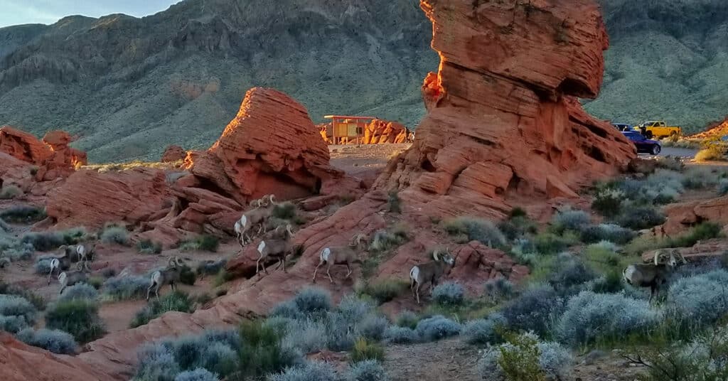
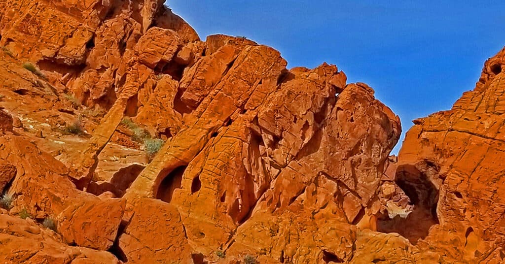
Rock Formations in Valley of Fire State Park, Nevada
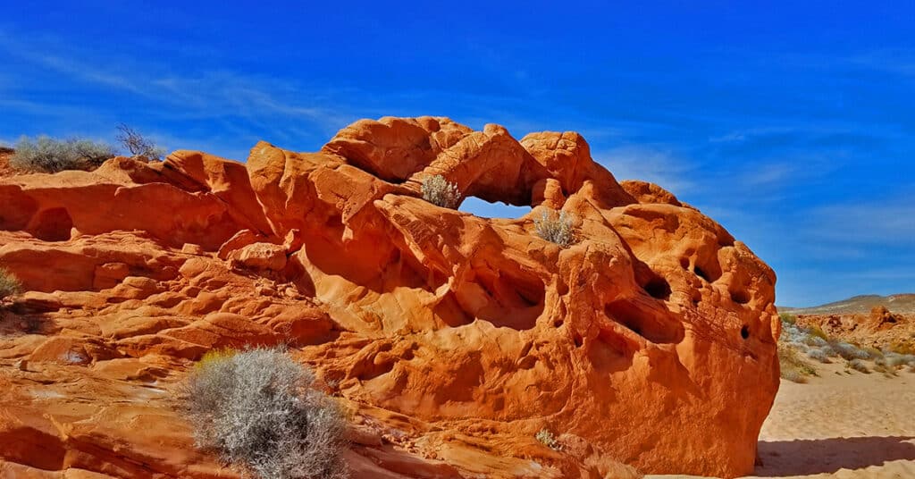
Entering Valley of Fire State Park is like entering into another world and the fiery red Azetc sandstone formations sharply contrasting against their gray and tan limestone mountain background create a fantasy-like atmosphere. Over countless years wind, water and sand have created a myriad of shapes and designs beyond all human artistic genius. And there is a spiritual feeling in the valley I have only experienced in few places on earth. This is a place you can touch, experience and even enter the very rock of the earth and feel an energy that is at times overpowering. Click image or title above for more…
Petroglyphs in Valley of Fire State Park, Nevada
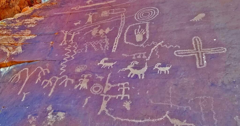
Some petroglyphs in Valley of Fire State Park, Nevada may be found at the top of the Atlatl Rock staircase (found next to Arch Rock,shortly beyond the West entrance to the park), but most are found on the Mouses Tank Trail (found on White Domes Road shortly after the visitor center). The petroglyphs on Mouse’s Tank Trail comprise the majority of the slides on this page. I know of no more complete study of the Valley of Fire Petroglyphs than the 74-page Master of Arts Degree in Archaeology thesis “Valley of Fire Petroglyphs: A New Perspective On An Old Idea” by Eric Pacl. There’s a link to download the entire thesis in this article. Click image or title above for more…
Balancing Rock Trail, Valley of Fire State Park, Nevada
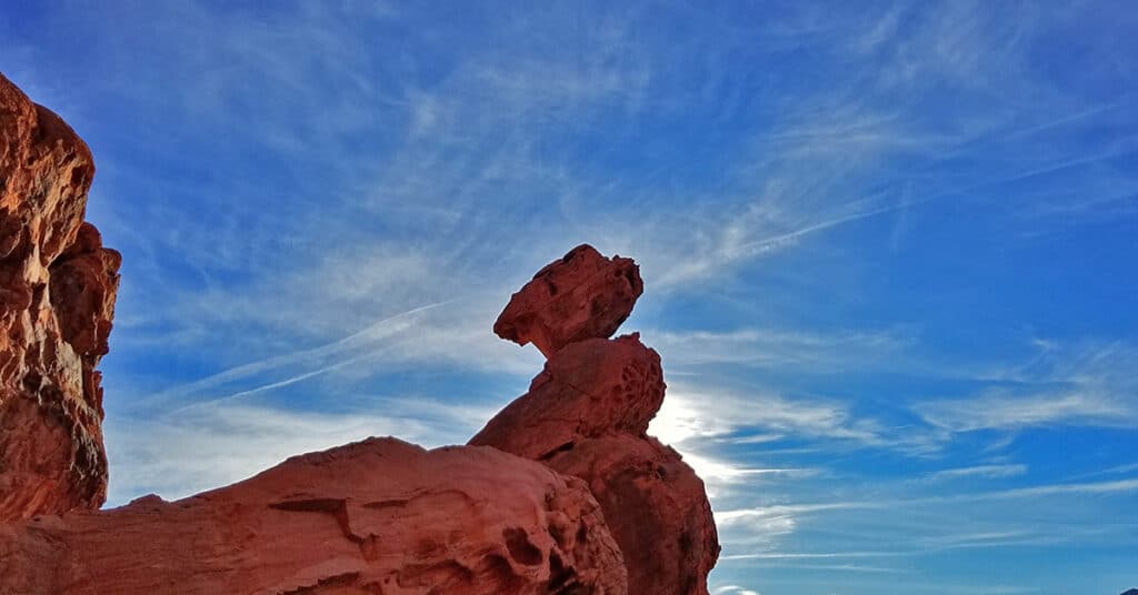
Balancing Rock is one of those weird rock formations in Valley of Fire State Park, Nevada, that appear to defy the laws of gravity and physics. How did the rock end up in that insane balancing position? What can we learn from balancing rock? From the Valley of Fire Visitor Center, the out and back trail to balancing rock is only about .2 miles so you don’t need to hike far to experience it and come up with your best theories! Click image or title above for more…
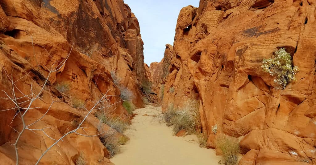
Charlie’s Spring Trail in Valley of Fire State Park, Nevada
Charlie’s Spring Trail in Valley of Fire State Park, Nevada, was an unexpected amazing discovery. While the idea of a desert oasis is always inviting, I was expecting to travel down a flat desert wash with little variation all the way to the oasis. However, after the first few miles, the wash unexpectedly took a dive into a beautiful red rock canyon before reaching the oasis. Route description: About 8 miles RT; **Mostly Wilderness, No Trail** Click image or title above for more…
Elephant Rock Loop in Valley of Fire State Park, Nevada
Elephant Rock stands in a small grouping of lighter rocks against a backdrop of larger red rock hills near the East end of Valley of Fire State Park, Nevada. When I heard there was a rock named “Elephant Rock”, my first reaction was , “Sure, someone had a vivid imagination and you’re going to need to really stare at this rock to see an elephant. It’s like looking at clouds or star constellations and trying to see the images that fit the names someone gave them long ago.” Then I saw Elephant Rock and there was no doubt–it immediately looked like an elephant! Route details: 1 mile loop; **Good Trail** Click image or title above for more…
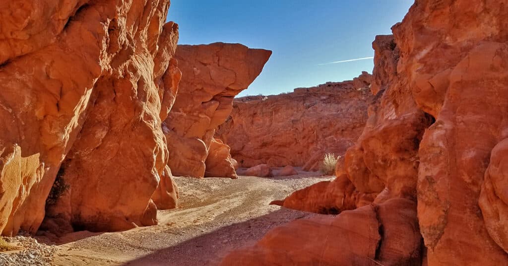
Fire Canyon, Valley of Fire State Park, Nevada
Fire Canyon in Valley of Fire State Park, Nevada is, as the name indicates, a canyon of fiery red rock formations both forming the canyon walls and throughout the canyon. As you pass through the canyon, you’re for the most part walking on a thick layer of beautiful red sand. This entrance to the canyon is at the end of the Rainbow Vista Trail. It’s seldom traveled, so watch for many animal footprints in the sand. Nearly every amazing red rock formation seen throughout the park can be seen in Fire Canyon including pinnacles, bee hive formations, balancing rocks, arches and shallow caverns. Route Details: Pick your distance, around 3mi RT; **Deep red rock sand surface…can drain your energy and fill your shoes!** Click image or title above for more…
Firewave in Valley of Fire State Park, Nevada
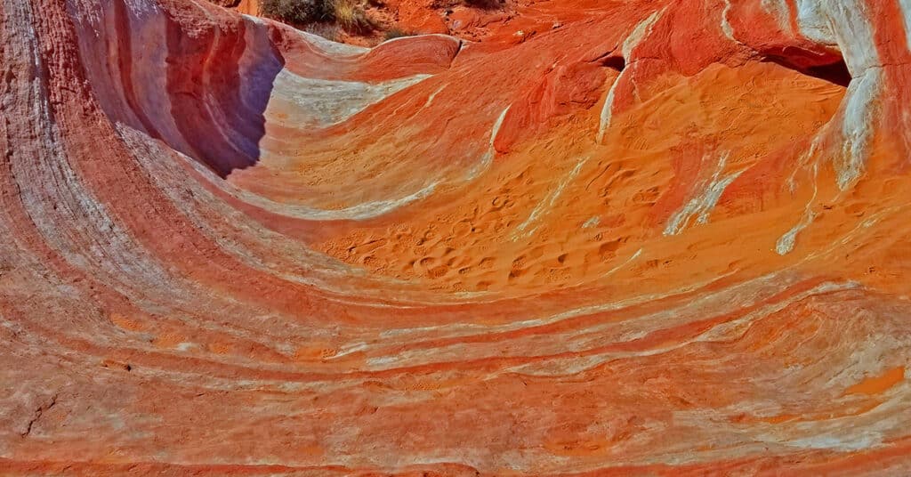
Firewave in Valley of Fire State Park is the most colorful place in the entire park with entire hillsides banded with dramatic colored stripes from white through countless shades of browns and reds. The main firewave area is pretty easy to access as it is only a mile from the parking area and the trail is relatively tame as trails go with only a few mild rocky areas to traverse. How the vivid stripe formations came about I do not know, unless perhaps there were a series of colored layers of sand laid one upon the other that were frozen and then gradually etched into the hills that lie in the valley today. Route Details: 2mi RT; **Firm but sandy surface. Well marked trail.** Click image or title above for more…
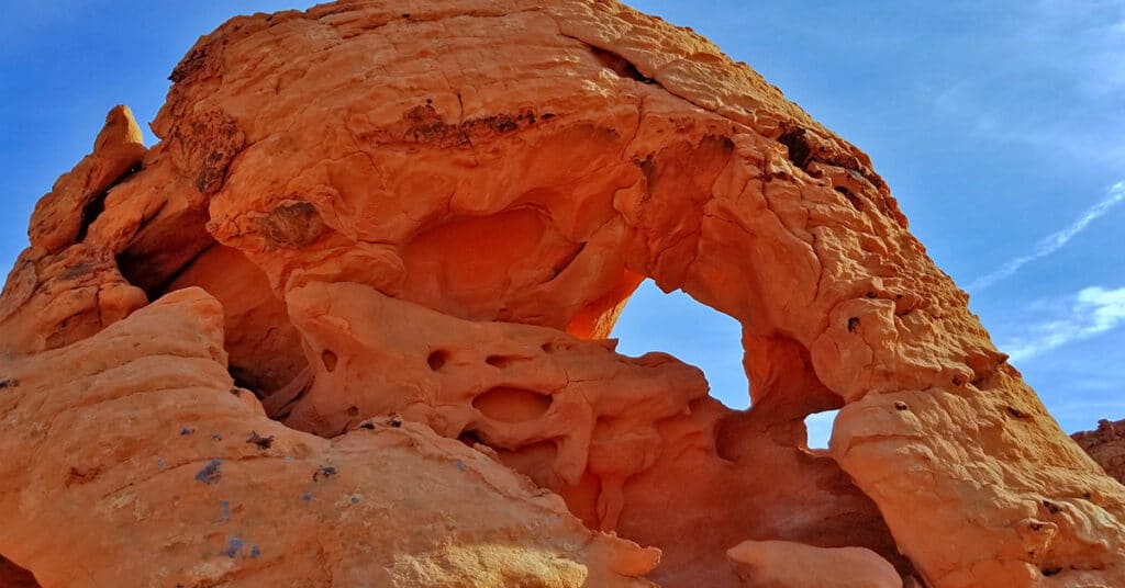
Natural Arches Trail | Valley of Fire State Park, Nevada
Natural Arches Trail in Valley of Fire State Park, Nevada is really an amazing journey through the Eastern end of Fire Canyon. Fire Canyon itself is surrounded by walls of beautiful red rock modeled into thousands of unique and wonderful shapes that flood your awareness and inspire your imagination. There are numerous natural arches and balancing rocks throughout the canyon all the way to the Silica Dome area and out the Western end of Fire Canyon. Route details: 6-8 miles RT; **Deep sand on a canyon floor** Click image or title above for more…
Old Arrowhead Trail in Valley of Fire State Park, Nevada
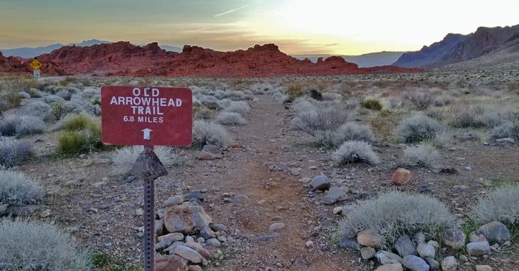
Old Arrowhead Trail in Valley of Fire State Park, Nevada, traverses the park East-West, just as Prospect Trail traverses the park North-South. It is part of an original 1915 era road from Las Vegas to Salt Lake City. The Western trailhead is located just beyond the West park entrance (near the Bee Hives); the Eastern trailhead is located just beyond the East park entrance (near Elephant Loop). Route details: 13.6 miles RT. Sketchy trail, fairly level but overall descends a gradual wash for 6.8 miles. Click image or title above for more…