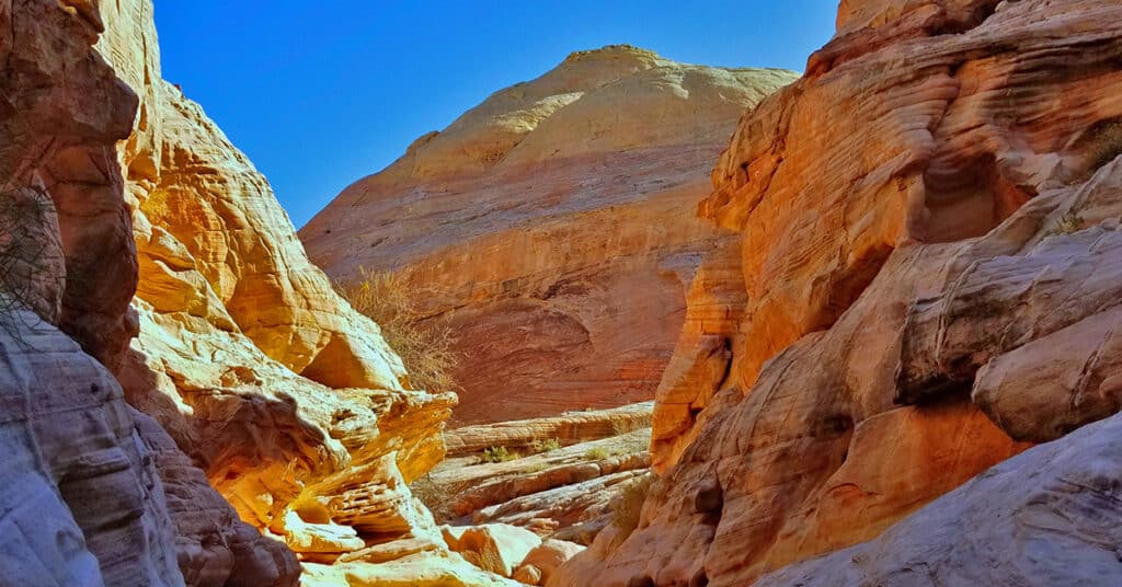
Fire Canyon, Valley of Fire State Park, Nevada
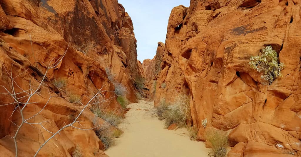
Fire Canyon in Valley of Fire State Park, Nevada is, as the name indicates, a canyon of fiery red rock formations both forming the canyon walls and throughout the canyon. As you pass through the canyon, you’re for the most part walking on a thick layer of beautiful red sand. This entrance to the canyon is at the end of the Rainbow Vista Trail. It’s seldom traveled, so watch for many animal footprints in the sand. Nearly every amazing red rock formation seen throughout the park can be seen in Fire Canyon including pinnacles, bee hive formations, balancing rocks, arches and shallow caverns. Route Details: Pick your distance, around 3mi RT; **Deep red rock sand surface…can drain your energy and fill your shoes!** Click image or title above for more…
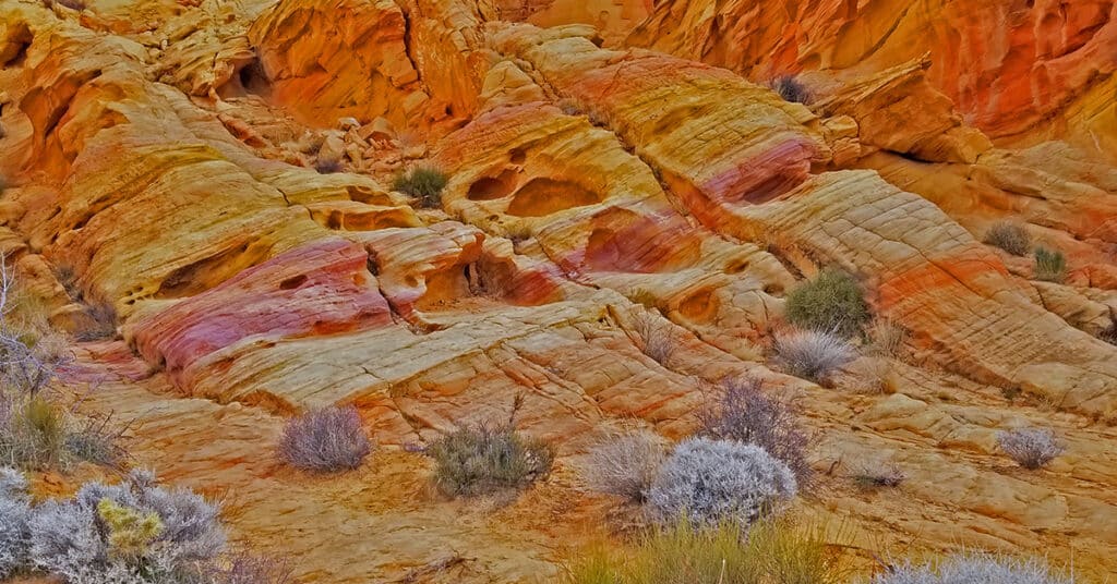
Firewave in Valley of Fire State Park, Nevada
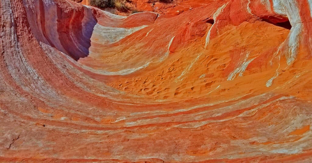
Firewave in Valley of Fire State Park is the most colorful place in the entire park with entire hillsides banded with dramatic colored stripes from white through countless shades of browns and reds. The main firewave area is pretty easy to access as it is only a mile from the parking area and the trail is relatively tame as trails go with only a few mild rocky areas to traverse. How the vivid stripe formations came about I do not know, unless perhaps there were a series of colored layers of sand laid one upon the other that were frozen and then gradually etched into the hills that lie in the valley today. Route Details: 2mi RT; **Firm but sandy surface. Well marked trail.** Click image or title above for more…
Natural Arches Trail | Valley of Fire State Park, Nevada
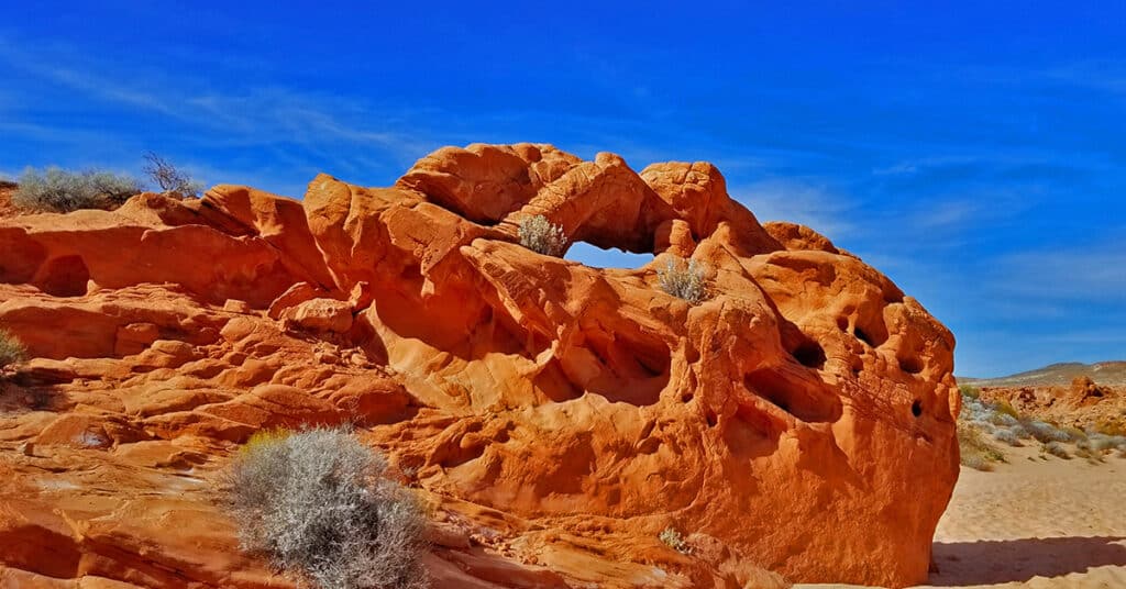
Natural Arches Trail in Valley of Fire State Park, Nevada is really an amazing journey through the Eastern end of Fire Canyon. Fire Canyon itself is surrounded by walls of beautiful red rock modeled into thousands of unique and wonderful shapes that flood your awareness and inspire your imagination. There are numerous natural arches and balancing rocks throughout the canyon all the way to the Silica Dome area and out the Western end of Fire Canyon. Route details: 6-8 miles RT; **Deep sand on a canyon floor** Click image or title above for more…
Old Arrowhead Trail in Valley of Fire State Park, Nevada
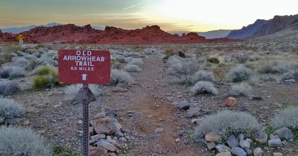
Old Arrowhead Trail in Valley of Fire State Park, Nevada, traverses the park East-West, just as Prospect Trail traverses the park North-South. It is part of an original 1915 era road from Las Vegas to Salt Lake City. The Western trailhead is located just beyond the West park entrance (near the Bee Hives); the Eastern trailhead is located just beyond the East park entrance (near Elephant Loop). Route details: 13.6 miles RT. Sketchy trail, fairly level but overall descends a gradual wash for 6.8 miles. Click image or title above for more…
Pinnacles Loop Trail in Valley of Fire State Park, Nevada
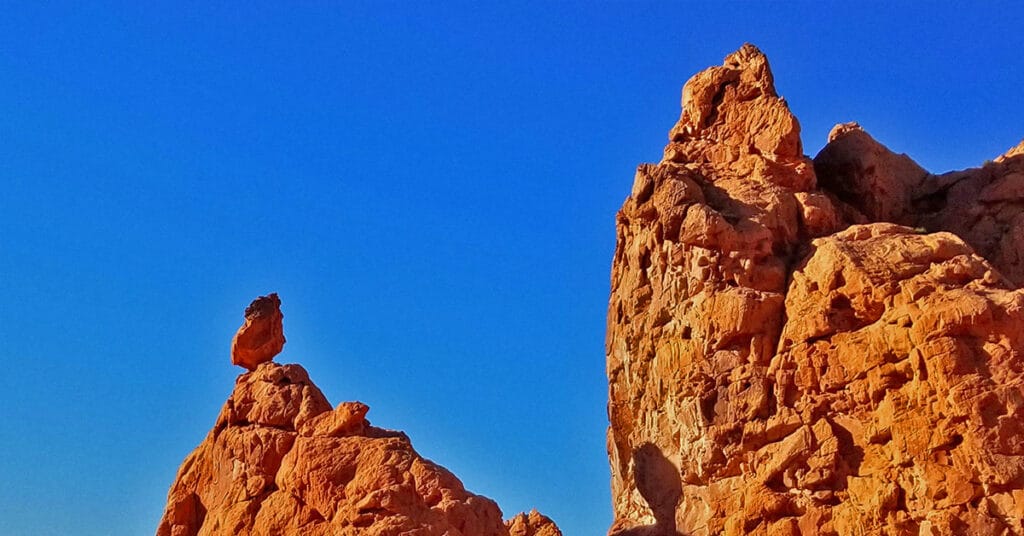
Pinnacles Loop Trail, featuring a hidden valley of brilliant fiery red pinnacle rock formations, is a great initial exposure to the wonders of Valley of Fire State Park. Entering the pinnacles is like entering another world. A balancing rock stands out, apparently defying the laws of gravity. I became obsessed with this rock as you can see in the video on this page, trying to figure out how it could possibly remain on its perch. Route details: 4.5-mile loop trail; **Not always clear where the trail is, but just circle the large central hill** Click image or title above for more…
Prospect Trail | Valley of Fire State Park, Nevada
The Prospect Trail in Valley of Fire State Park spans much of the park from near the West entrance to the White Domes Loop at the end of the Mouse’s Tank Scenic Drive. Not only does it span much of the park, but it also offers one of the widest variety of rock formations and colors seen on any other trail in the park from the 200 million-year-old red Azetc sandstone formations also seen on Pinnacles Loop, Fire Canyon, Mouse’s Tank Trail the Bee Hives and Atlatl Rock to the white sandstone formations seen in locations such as White Domes and Silica Dome to the variety of colors seen on the Rainbow Vista Trail to the red and white striped display seen on Fire Wave Loop. Route details: 11 miles RT; **Good trail – a bit sketchy in places.** Click image or title above for more…
Rainbow Vista Trail, Valley of Fire State Park, Nevada
The Rainbow Vista Trail in Valley of Fire State Park, Nevada is a quick 1.0 mile trail with two main features. The “rainbow” part of the name is mostly at the beginning of the trail with rock formations colored in shades from white to brown to red. The “vista” part of the name refers mostly to the grand Fire Canyon overlook at the end of the trail. Route details: Approx. 2mi RT; **Path through hills.** Click image or title above for more…
Silica Dome | Valley of Fire State Park, Nevada
Silica Dome in Valley of Fire State Park, Nevada is just a very fun experience offering a combination of trail hiking and light but exciting rock climbing on an amazing surface. Silica, from which Silica Dome get’s its name, is the major constituent of sand. The dome itself is composed of very pure nearly white silica in rock solid form. Apparently, you do not want to breathe in the silica dust because it is a lung carcinogen and exposure can result in the disease of silicosis. Route details: 2mi RT Wander Around and On the Dome. Click image or title above for more…
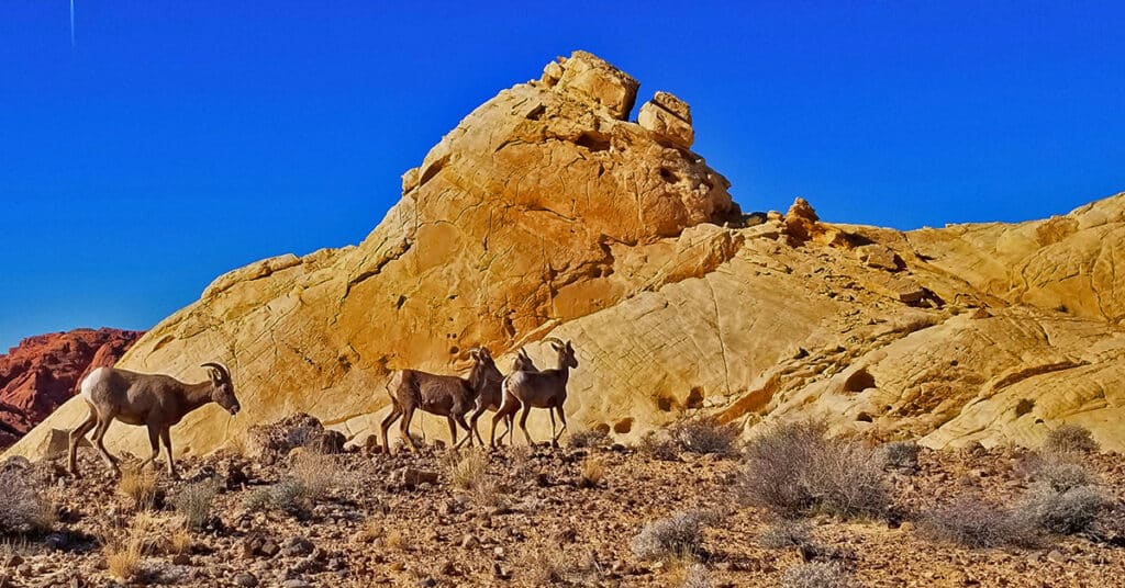
White Domes Loop Trail in Valley of Fire State Park, Nevada
White Domes Loop Trail in Valley of Fire State Park, Nevada is a relatively easy but totally amazing 1-mile loop trail featuring colorful red Aztec sandstone that was originally sand dunes 200 million years ago in the Jurassic age of the dinosaurs. Another feature of the loop is an abandoned Hollywood set from the 1966 American western film “The Professionals“. Route details: 1-Mile Loop; **Decent trail, some stairs.** Click image or title above for more…
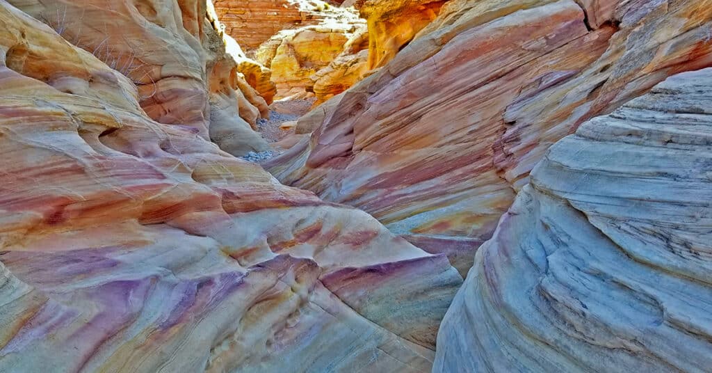
Anniversary Narrows, Muddy Mountains Wilderness, Nevada
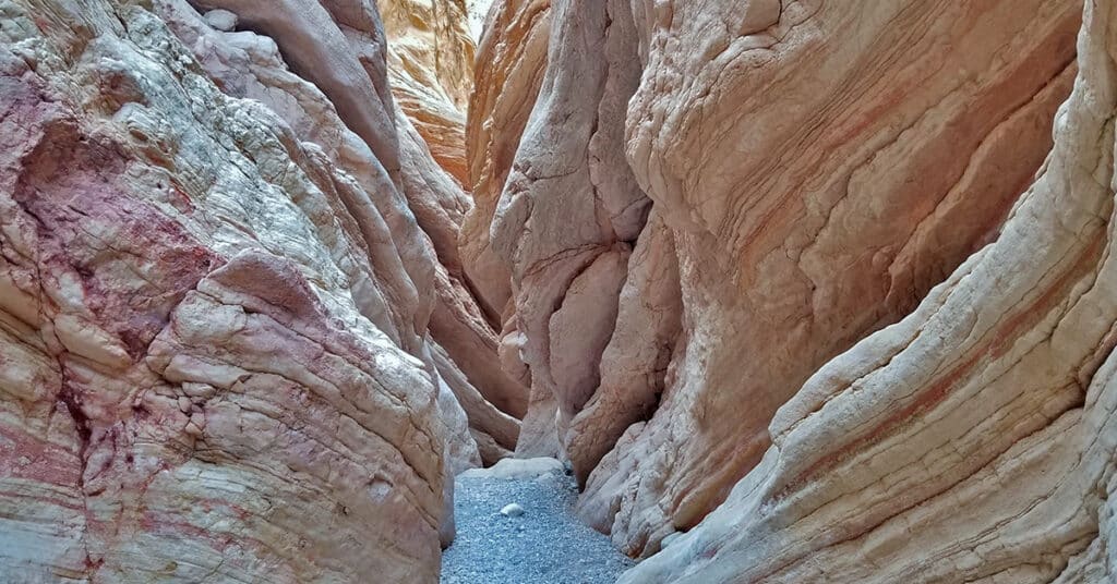
Anniversary Narrows in The Muddy Mountains Wilderness of Nevada is one of the most beautiful slot canyons in the state. If you’re into slot canyons, Anniversary Narrows is a must see no matter where you’re from. The intricate turns in the canyon along polished rock walls carved into millions of unique shapes lit up by a narrow slit 100s of feet above change in color with the advance of the sun throughout the day. It’s like wandering through a magical maze with a new, unexpected view beyond your wildest imagination around every turn. Route details: 10 mi RT; **Some Trail, Some Wilderness** Click image or title above for more…