Northshore Road | Lake Mead National Recreation Area, Nevada
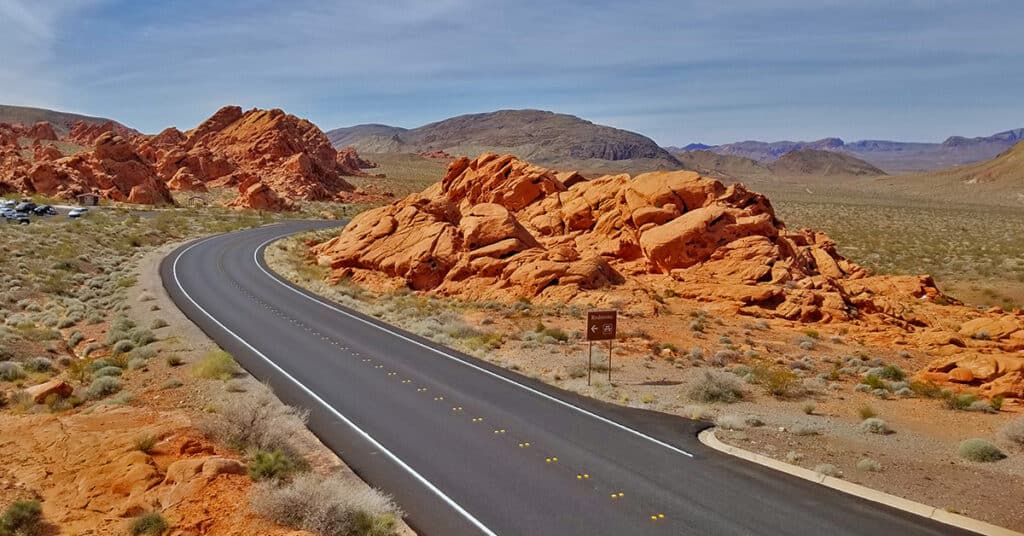
Though Lake Mead National Recreation Area includes a few commercial developments, it is largely an untouched wilderness rivaling places like the Mt. Charleston Wilderness, the La Madre Mountains Wilderness and the Sheep Range. Here’s a quick tour of Northern Lake Mead NRA. Our overview adventure begins at the East entrance to Valley of Fire State Park. We note landmarks by the mile markers on Northshore Road which begins at mile 45.1 and ends towards Hoover Dam at mile 0. Route details: 45.1-mile tour of Northshore Road and various waypoints. Click image or title above for more…
Callville Summit Trail, Lake Mead National Recreation Area, Nevada

Callville Summit Trail is a great way to experience the area around the Lake Mead shoreline in a brief 1-2-mile excursion. You’ll get an idea of hiking conditions in desert terrain without committing yourself to a more extensive remote adventure. Hiking conditions include navigating loose rock, sudden drop-offs, high desert heat and other conditions unique to low desert adventures in the Southwestern U.S. Route description: 2-3mi | 1,229 > 1,500ft; ** Rabbit Trails – Take Your Pick** Click image or title above for more…
Southern Bowl of Fire | Lake Mead National Recreation Area, Nevada

You can stand in the midst of the Bowl of Fire and see the entire Bowl of those beautiful Aztec formations in one of the most incredible 360 degree vistas available anywhere. And then proceed through a gentle valley to the North surrounded on both sides by more formations. Route details: 5-6mi | 1,965 > 1,905ft; ** Some Trail, Some Wilderness** Click image or title above for more…
Northern Bowl of Fire | Lake Mead National Recreation Area, Nevada

The Northern Bowl of Fire is a massive Aztec red rock cliff system rivaling any other red rock formation in Nevada. The red rock is composed of frozen sand dunes from the Jurassic era, and the red coloring is caused by iron that leached up through the sand before it solidified into rock. The route I describe here offers spectacular 360 degree views of the Overton Arm of Lake Mead, the Hamblin Mountain area, portions of Lake Mead, the Southern Bowl of Fire, Anniversary Ridge, and the Muddy Mountains. Route details: 8mi RT | 1,887 > 2,568ft; ** Some Trail, Mostly Wilderness** Click image or title above for more…
Black Mesa, Lake Mead National Recreation Area, Nevada

Black Mesa in Lake Mead National Recreation Area has a huge relatively flat summit over a mile in length from North to South. From the Southern Summit one can see one of the best views of Lake Mead to be had from any point in the area (except Fortification Hill). Black Mesa has no real marked and established trailhead. However, the route I took started at a pull-out about mile 10.5 on Northshore Road in Lake Mead National Recreation Area just a few hundred feet before the crossing of the major wash that skirts the West side of Black Mesa. Route details: 4mi | 1,538 > 2,198ft; ** Wilderness, No Trail** Click image or title above for more…
Arizona Hot Spring | Liberty Bell Arch | Lake Mead National Recreation Area, Arizona

Arizona Hot Spring is a natural hot spring nestled in a narrow slot canyon about 1/4th mile above the banks of the Colorado River. It’s a popular hang out for many fans of the hot spring who make it a day adventure. Liberty Bell Arch is a pretty impressive natural arch spanning an open area beneath that actually has taken on the shape of the Liberty Bell. Route details: 8-10mi | 1,536 > 661ft; **Mostly Good Trail** Click image or title above for more…
Potosi Mountain Southern Approach | Spring Mountains Wilderness | Nevada

The Southern approach to Potosi Mountain is nothing less than a huge endurance test. Though it’s only 14 miles out and back from my starting point at the “warning rock” parking area, and you’re on a pretty good road all the way to the summit, the angle of incline is the challenge. Think streets of San Francisco, only instead of a one block steep incline you’re looking at half-mile sections of incredibly steep incline. The incline is so steep in places that you’re gaining nearly one foot elevation gain per stride! One note: your total ascent is between 3,500 and 4,000ft. Route details: 14 mi RT/ 4,700ft > 8,500ft; **Paved and Unpaved Maintenance Roads** Click image or title above for more…
Potosi Mountain | Northern Hills Exploration | Spring Mountains, Nevada

During this adventure, though I do not ascend to the summit, I scope out the Northwestern area of Potosi Mountain and discover a few alternate summit approaches. Potosi Mountain, Elevation 8,517ft, is the last high point along the horizon in the Spring Mountains as you’re viewing the skyline from Las Vegas. From Potosi Mountain’s 8,517ft summit, populated with a number of communications towers, you can look across the entire stretch of the Rainbow Mountains. Route details: 16 mi RT from Hwy 160/ 5,500ft > 7,200ft; **Unpaved Road then Wilderness (no trails)** Click image or title above for more…
Potosi Mountain Northern Cliffs Trail | Spring Mountains, Nevada

The Potosi North Trail is very well constructed and the views are spectacular — both along the trail and off in the distance. Along the trail there are elaborate rock formations including pinnacles and a few small natural bridges branching out from the spectacular limestone cliff face. The plant life is rich, a mountain pine forest. Then, there is the distant back-drop including Lovell Canyon bordered by Griffith Peak and Harris Mountain with Mummy Mountain dead center. Route details: 16 mi RT from Hwy 160/ 5,500ft > 7,500ft; **Unpaved Road then Wilderness (no trails)** Click image or title above for more…
Potosi Mt Summit via Western Cliffs Ridge | Spring Mountains, Nevada

The Potosi Mt Western Cliffs Ridge is not only a spectacular route with views that do not end, but it is also a historical site, the location of Potosi Mine. This route discovers a nice trail beginning at the end of Potosi Springs Road and heading upward to the old route from the aerial tram site to the Potosi Mine. I believe wide, well constructed route between the high point of the tram and the mine was the route of the baby gauge railroad. Upon meeting the Potosi Mine route another very faint use trail continues up and along the Western Cliffs Ridge. That faint trail appears and disappears, but the ridge eventually leads to Potosi Mountain summit. Route details: 20+ mi RT from Hwy 160/ 5,500ft > 8,500ft; **Unpaved Road, Some Trails, Some Wilderness** Click image or title above for more…