02 Lee to Kyle Canyon | Overview | Mt Charleston Wilderness | Spring Mountains, Nevada

Ascending the ridge from Lee to Kyle Canyon is like crossing a bridge to another world. I’ll never forget that first moment, after long weaving through deep wilderness slopes, that I reached the Lee/Kyle Canyon upper rim. Topping that last hill, suddenly the world of Kyle Canyon with its familiar peaks was there! There are no trails from Lee to Kyle Canyon. However, this point I have found a number of wilderness routes that ascend from Lee to Kyle Canyon, each uniquely magical in nature. This page lists those routes and provides links to the individual adventure pages with the details, videos and images for each route. Best time of year for adventures here: Early Summer to Mid-Fall. Temperatures at the higher elevations are usually in the mid-70s even when Las Vegas Valley is up to 115 degrees! Expect to navigate snow at other times of the year. Follow thumbnail images to view the details you will need to plan your adventures here. Click image or title above for more…
Deer Creek Rd, Mummy Springs, Raintree, Fletcher Peak Circuit Adventure | Mt. Charleston Wilderness | Spring Mountains, Nevada

This comprehensive circuit adventure covers most of the entire Eastern section of the Mt. Charleston Wilderness including the canyon off Deer Creek Road at the base of Mummy’s Head, the ridge leading up the left (East) side of that canyon to the very Northeastern tip of Mummy Mountain’s mid and highest section (Mummy’s Tummy), the route across the wilderness at the base of Mummy’s Eastern cliffs to Mummy Springs, then on to Raintree and the intersection of the North Loop Trail, the brief stretch of the North Loop Trail to its intersection with Fletcher Peak Trail, the summit of Fletcher Peak, then the return past Raintree and Mummy Springs to the Cougar Ridge Trail and finally the descent back to Deer Creek Picnic Area and Deer Creek Road where the adventure began. Route Details: 15-18 mi / Approx 8,000ft > 10,500ft; **Some Trail > Some Wilderness** Click image or title above for more…
Mummy Mountain Toe, Mt. Charleston Wilderness | Spring Mountains, Nevada

The Southwestern edge of Mummy Mountain forms a sheer cliff over 1,000ft in height on 3 sides and that cliff is referred to as Mummy’s Toe. Mummy’s Toe, though unknown by most hikers in the Mt. Charleston Wilderness, is a awesome destination hike in itself. Like the bow of a ship the 270 degree view to the South, East and North is unmatched. Route details: 14 mi / Approx. 8,439 > 11,000ft **Some Trail > Some Wilderness** Click image or title above for more…
Mummy Springs Loop | Cougar Ridge Trail | Mt. Charleston Wilderness, Nevada

Mummy Springs Loop is an awesome hiking or trail running workout! You’ll park at the North Loop Trailhead, take a short 1/8th-mile stretch down Deer Creek Road to Cougar Ridge Trail Road, ascend that road and trail about 2000 feet straight up the healthy incline of Cougar Ridge Trail, take a left at Mummy Springs Trail, Cross beneath Mummy Springs, head to Raintree then take a left down the North Loop Trail back to the North Loop Trailhead. Route details: 10 mi / Approx. 8,439 > 10,023ft **Excellent Trail** Click image or title above for more…
Mummy Mountain SE Approach in Mt. Charleston Wilderness, Nevada

Mummy Mountain Eastern approach is a fascinating journey including well established trails, traverse across largely untouched wilderness area, ascent up steep avalanche slopes, traverse along the edge of cliffs along with a brief ascent up a 10ft vertical rock wall with a 100ft drop-off below. Route details: 16 mi / Approx. 8,439 > 11,530ft **Some Trail > Mostly Wilderness** Click image or title above for more…
Mummy Mountain NNE, Mt. Charleston Wilderness, Nevada

This adventure extends the exploration of the East side of Mummy Mountain through the wilderness to a viewpoint overlooking the Northern area of Mummy Mountain. From this pretty amazing viewpoint one can see the entire East side of Mummy Mountain with all the Eastern cliff approaches, look to the South to view Mummy’s Toe along with its full approach, and to the North, a unique view of Mummy’s head along with potential routes that might take one around the Northern side and on up to Mummy Mountain summit. Route details: 14 mi / Approx. 8,439 > 11,151ft **Some Trail > Mostly Wilderness** Click image or title above for more…
Mummy Mountain Northern Wilderness Overlook & Exotic Ancient Bristlecone Pines
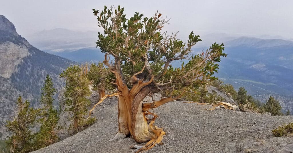
This adventure is a brief extension of the Mummy Mountain NNE adventure. This adventure moves to the very edge of the NNE area where the only way forward is a pretty dramatic descent either to the Lee Canyon area or to potential routes allowing re-ascent of the Mummy Northern cliff area just below Mummy’s Head – more accurately, Mummy’s neck. In addition, this adventure also documents some of the amazing ancient Bristlecone Pine trees in the largely untouched Mummy Mountain Northern area. Route details: 14 mi / Approx. 8,439 > 11,000ft **Some Trail > Mostly Wilderness** Click image or title above for more…
Mummy’s Toe, Knees, Raintree, Fletcher Peak Circuit from Deer Creek Park, Nevada

This cool circuit adventure is packed with spectacular views and enchanting waypoints. Yet it is compact enough to accomplish in less than one incredible day. The circuit begins at the North Loop Trailhead in the Mt. Charleston Wilderness. From there descend on Deer Creek Road about a quarter to a half mile to Deer Creek Picnic Area. From the Deer Creek Picnic Area parking area, ascend through Deer Creek Park and on up via the Cougar Ridge Trail to Mummy’s Knees. Then traverse over to Mummy’s Toe. Descend to Mummy Springs and then on over to Raintree. Take the North Loop Trail from Raintree toward Fletcher Peak. Take the Fletcher Peak out and back trail from the North Loop Trail to the summit of Fletcher Peak. Finally, descend from Fletcher Peak summit back to the North Loop Trailhead where you began. Route details: 15-18 mi / Approx. 8,439 > 11,000ft **Some Trail > Some Wilderness** Click image or title above for more…
Mummy Mountain Summits Overview | Mt. Charleston Wilderness | Spring Mountains, Nevada

Discover the three main summits of Mummy’s Head and how to get there either from Lee Canyon or from Deer Creek Road. Click the image or title above for details.
Fletcher Peak from Robbers Roost | Spring Mountains, Nevada

There is a little-known canyon between Robbers Roost and Fletcher Peak in the Mt. Charleston Wilderness of the Spring Mountains, Nevada. The canyon is bordered by majestic cliffs and is a climate zone unto itself populated by a forest at its base that in places grows up the solid cliff walls. At the top of the steep avalanche slopes there is a far more gentle, forested ridge continuing upward and finally connecting with the North Loop Trail about 1/4th mile before the unmarked turn-off to Fletcher Peak. Route Details: 10 mi+ / Approx. 7,914 > 10,255ft **Mostly Wilderness** Click image or title above for more…