Overview | Castle Rock Loop | Desert National Wildlife Refuge, Nevada
Where is Castle Rock Loop?
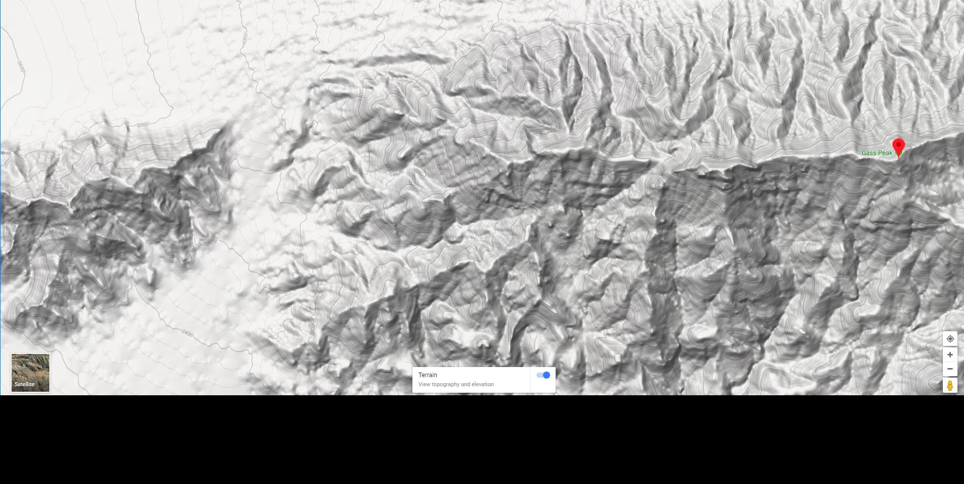
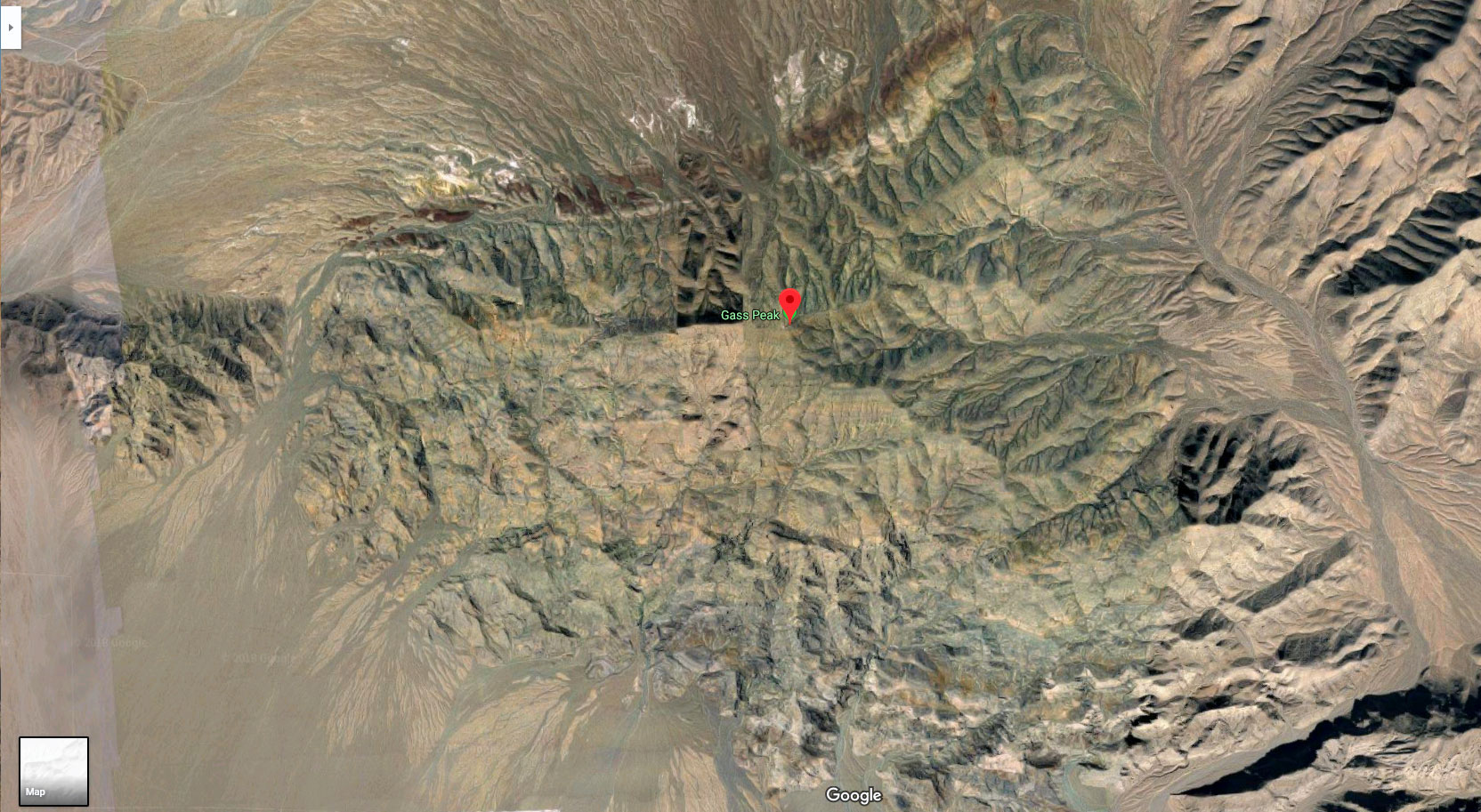
Castle Rock is a 1.5-mile limestone ridge on the West side of the larger Gass Peak above the NW edge of Las Vegas, Nevada. The 17.5-mile pathless desert wilderness loop over and around Castle Rock begins at the upper end or Rainbow Blvd. The route passes through the gap between 4,500ft elevation Castle Rock and 6,937ft elevation Gass Peak, then ascends the ridgeline, either completing the length of the ridgeline summit or descending to an unpaved road along the North base of the ridge. Finally, after rounding the West end of the ridge the loop finishes with a traverse through the desert back to the starting point on Rainbow Blvd.
Why Hike the Castle Rock Loop?
- It would be hard to find a wilderness route with more cool features than the Castle Rock Loop. Here are a few:
- Easy getting to the starting point: The loop begins right on the edge of the Las Vegas Metro Area.
- No Entrance Fees
- Remote Wilderness Experience: As you almost immediately enter the Desert National Wildlife Refuge–largest wildlife refuge in the lower 48 states–within a few minutes you leave the city behind and feel as though your 100s of miles away.
- Variety of Terrain: You’ll gradually gain over 2,000ft as you cross a maze of totally barren badlands, ascend a huge alluvial fan populated by desert creosote, yucca and cacti, discover ancient 450-million-year-old sea fossils if you know where to look, pass through a beautiful Joshua Tree forest and enjoy a challenging rock scramble choosing a comfortable level of difficulty.
- Spectacular Views: View the entire Las Vegas Metro Area from this high Northern vantage point as you’ve never seen it before, along with its vast surrounding mountainous wilderness.
- Choose Your Difficulty Level: The summit slope of Castle Rock offers a wide variety of rock scrambling levels and it’s fairly easy to choose your level of difficulty at every point along the way from a high Class 2 walk to the most challenging Class 3 rock scrambling.
What Will You See from the Castle Rock Loop?
Here’s a short list in a clockwise direction:
In short, you’ll see a huge slice of Southern Nevada Wilderness!
What’s the Best Time of Year to Hike Castle Rock?
Stick to late Fall through early Spring. There are only a few Winter days that can bring snow and ice, and it melts within a week or two. Avoid late Spring through early Fall…especially mid-Summer that can bring dangerously high temperatures exceeding 115 degrees.
Bring At Least 4-5 Liters of Water!
Though it’s at the edge of a huge metro area, this is desert terrain and can be extremely dangerous. Unprepared hikers have lost their lives in sight of the city! Dehydration and heat related issues are the main culprits. If it’s Winter and temperatures are in the 60’s (in Las Vegas) 4 liters should do. As temperatures rise toward the 80’s (in Las Vegas) up to 6 liters are essential. Above the 80’s (in Las Vegas) I wouldn’t do this adventure…go for higher ground with adventures starting at around 7,000ft.
Directions to Route Starting Point | Castle Rock Loop | Desert National Wildlife Refuge, Nevada
Take I-11 North from Las Vegas. About 15 miles North of the Strip, take the Durango exit and turn right onto N. Durango Dr. In about a mile, turn right onto Grand Teton Dr. In another mile turn left onto N. Rainbow Blvd. and continue on that road for a couple blocks until it ends. Find a small parking area that can accommodate 3-4 vehicles along a chain link fence at the end of Rainbow Blvd. You’ll see a nice pedestrian opening way in the fence there.
Narrative Guide | Castle Rock Loop | Desert National Wildlife Refuge, Nevada
Getting Your Initial Bearings
While standing at the parking area at the upper end of Rainbow Blvd. look across the desert to the North to see the massive 6,937ft Gass Peak. To the right is the smaller 4,500ft, 1.5-mile long summit ridgeline of Castle Rock. You’re going to pass through the gap between these two high points, take a left and traverse the summit ridge of Castle Rock (possibly at some point descend to the unpaved road behind Castle Rock), circle around the West (left) side of Castle Rock and traverse the desert back to where you are standing. Though it’s through pathless wilderness, it’s one of the simplest wilderness routes you’ll ever experience.
If it’s a clear day you’ll be able to navigate by sighting high points in the wilderness surrounding Las Vegas, along with distinctive points in the Metro Area. If it’s cloudy, as it was when I first made this loop, a GPS or compass will be helpful because very soon as you ascend away from the Metro Area, everything down there begins to look the same. It would be easy to miss your starting point by as much as 2-3 miles if you are not careful in setting your return trajectory. However, even if you miss the starting point as I did in the cloudy darkness, it’s not hard to find your way back. Trying to return without resorting to GPS, I landed on the hiking and bike paths just East of Tuli Lake Park. A left turn and a half-mile easily got me back to the start.
Rainbow Blvd to the Desert National Wildlife Refuge Boundary
Sighting the right (East) side of the pass between Gass Peak and Castle Rock, just head directly to that point. You’ll be able to see it all the way up! Note that along the way you will come across a few old ATV trails and roads that seem to offer some streamlined help. Every time I followed any of those roads or trails they invariably took me off course…except for the final road along the East side of the gap approaching the gap summit. That road guides your final approach to the summit of the gap.
With the above target point in sight, first skirt the edge of the residential area to your left…about a quarter mile long. At the edge of the residential area there is a cable fence supported by short wooden poles. Remarkably, this fence marks the Southern boundary of the Desert National Wildlife Refuge, largest wildlife refuge in the lower 48 states! The refuge was established to preserve the Big Horn Sheep population. Even more remarkably, a few years ago the boundary was about 2.5 miles further North, you’ll cross that fence later. This indicates a huge expansion of the wildlife refuge, winning out over urban sprawl. No further expansion for the city. Where else in our country are wilderness areas growing and stopping urban sprawl? Not many places. Celebrate this victory as you pass the new wilderness boundary!
Desert National Wildlife Refuge Boundary to the Badlands Crossing
Once beyond the residential area you’ll be surprised how quickly the Las Vegas Metro Area melts into the scenery and the surrounding mountains begin to command the view! Soon you can see the Vegas Strip and all the mountains mentioned above. It’s amazing! In less than 30 minutes you’ll feel as if you’re 100s of miles from civilization.
You’re ascending a very gradual incline that will slowly become steeper, especially near the gap between Castle Rock and Gass Peak above, but never challengingly steep.
As you ascend, be sure to look back in order to identify the return target point. The mountains you are approaching are easy to identify, but your starting point is a much smaller target during the return trip. A miscalculation on the way back could result in you missing the starting point by 5 miles or more! Everything looks the same when you’re at the mountains above looking back down! Look back to the mountains on the horizon South of Las Vegas. Those mountains will be visible all the way down. I identify a small double-peak summit South of Las Vegas that lines up perfectly with the starting point. Head toward those double peaks on the return trip and you will end up exactly at your starting point. See the video on this page for identification of those peaks.
Continue toward the mountains above, at first traversing rather flat desert terrain. You’ll cross under some major powerlines with huge metal towers, then you encounter the first challenge of the day: The badlands!
Badlands Crossing to the Huge Alluvial Fan
The badlands are a huge maze of hills, ridges and water channels running across your adventure route. They form a strip about 100 yards wide and you’ll need to weave your best route through the strip. The hills and ridges have a dirt surface coated with a thin layer of small chunks of dried mud with the consistency of ball bearings! Watch your step especially as walking on the gullies and ledges you’ll need to follow to cross the badlands is like walking on ball bearings. Some of the ledges have a 20ft or more vertical drop, so stay away from the edge. Fortunately, it’s easy to find gradual slopes and gullies to help you through the badlands. As a side note, if you headed a couple miles West along this same strip of badlands, you’d be in the Tule Springs Fossil Beds National Monument. The strip of badlands you are now crossing is just as full of fossils as that national monument!
Alluvial Fan to the Gap Road
Once you’re through the Badlands, you begin ascending the huge alluvial fan toward the summit gap. An alluvial fan is composed of sediment deposits that have washed down from the mountains above. There are many waterways streaming down through the alluvial fan. At first the waterways are very shallow, but higher up they can deepen to mini-canyons with 20-30ft vertical edges. You can easily navigate the alluvial fan all the way up and weave your way across any gullies (they’re dry except during very rare rain events). Just find gradual passages and avoid trying to descend or ascend the steeper edges with their loose rock surface…that wouldn’t end well!
Fossils on the Alluvial Fan
Alluvial fans, being the deposits of sediment washed from above, have a huge variety of rocks. A geologist would have a field day! I’ve found that the darker limestone rocks are the oldest, and most likely to contain 450-million-year-old sea fossils from the shallow inland sea that once covered the area. In the video I film a rock containing an ancient nautilus fossil. Limestone is ancient sea bottom mud, and when the sea creatures died, their shells sank into the mud. The shell calcium combined with the mud to create a rock hard cement, which is the now the limestone you are walking upon.
Variety of Plants on the Desert Alluvial Fan
Notice how the plants get larger as you ascend the alluvial fan. The Badlands below were pretty barren. Near the base of the fan you’re weaving among small creosote plants. Notice how they are evenly spaced about 10-15 feet apart. They put out a poison in their roots that keeps other plants from growing too close. This is their way of carving out a territory that ensures enough water for their survival. Higher up, you’ll begin to see a variety of cacti, the largest being huge California Barrel Cacti. Very beautiful! Further up Yucca begin to appear, and finally, in the gap, there’s a beautiful Joshua Tree forest that’s in full bloom around April and May with huge white blossoms on every branch!
The Gap Road to the Gap Summit
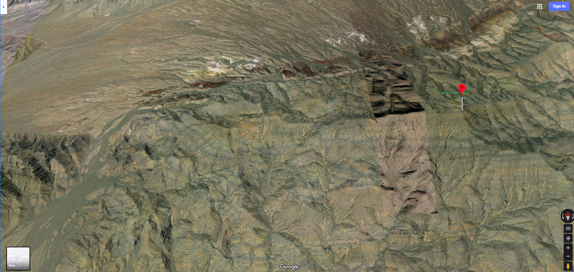
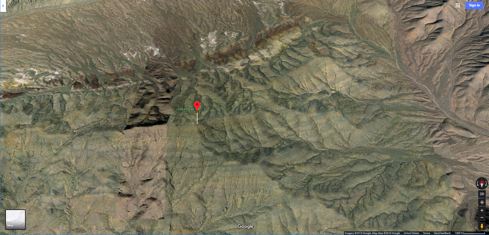
As you enter the gap, watch for an old unpaved road near the right (East) side of the gap, along the base of Gass Peak. Where other roads and paths you may have encountered earlier invariably take you off course, this road will lead you all the way to the summit of the gap, circumventing a number of obstacles and streamlining your progress. As you ascend the road notice some cool California Barrel Cactus rock gardens along the way. Also, observe the terrain of the mountains on either side of the gap. There are a number of interesting canyons and ridges along the West side of Gass Peak to your right. The layered structure of Castle Rock to your left is a great demonstration in how to determine the nature of the terrain on the opposite side of a mountain. Notice how the layers are angled with a diagonal incline. Though the South side of Castle Rock is very vertical, the angle of the layers reveals the more gradual angle of incline on the opposite side of the mountain!
Remember to turn around often to enjoy the spectacular view behind and also to confirm your return path target point…those two small peaks I mentioned earlier.
The road, though steep in places, is a pretty simple guide. At the gap summit there is a fence with a large opening. Across the gap to the North, the Sheep Range and Fossil Ridge appear. Fossil Ridge is the low, colorfully layered ridge. The Sheep Range is the higher backdrop, around 10,000ft in elevation. Both of these are reached much more directly from the Desert National Wildlife Refuge visitor center on Corn Creek Road off of I-11 North of Las Vegas.
Gap Summit to Castle Rock Summit Slope and Ridgeline
The road that brought you through the gap and to its summit splits at the gap summit. The right branch leads around the North base of Gass Peak, offering some cool access points and adventures to that peak. The left branch leads around the North base of Castle Rock, always offering a way to streamline your path around the loop if you run out of time navigating the summit ridge. At just about every point along the way you can descend to the road for an easy completion of the Castle Rock Loop.
So, take the left road split at the gap summit and head for the incline to the summit slope of Castle Rock, just ahead.
Castle Rock Summit Slope and Ridgeline
As you begin ascending the long Castle Rock summit slope, you can pick your level of difficulty all the way up to the summit with its spectacular 360-degree views. At just about every point you can descend to the road below for an easy, streamlined completion of the loop and return to your starting point based on your energy, comfort level, weather conditions, time and water limitations. Do keep time in mind when you will need to descend from the summit slope to the road in order to make it back in time. You can always return on a later date.
Your main challenge along the summit slope is those huge limestone layers forming a series of ridges to cross along the way. Some of the ridges have 10-20ft vertical sides, but you can always find more gradual passages at various points along the ridges. It’s a fun challenge! Remember, when you’ve had enough rock scrambling or reach a barrier you find to be too much for today, you can always descend to the road below to complete the loop.
Notice the many caves in the limestone. There are even a few cool arches. Limestone is easily sculpted by the elements over time. The combination of sculpted limestone and spectacular views is incredible!
Looping Around to the West Side of Castle Rock and Return to the Starting Point
On this day, only 2 days beyond the shortest day of the year with clouds and threats of rain and early loss of daylight, descended to the baseline road after achieving the summit ridgeline a few times. The road really sped up progress. As it reached the West edge of Castle Rock it was soon apparent the road would continue West, so it was time to leave the road, circle around the West side of Castle Rock and then make a beeline back to the start point.
From this more Western angle, the best reference point for your return target is the Railroad Mountains to the right of Frenchman Mountain. But in this case the clouds had thickened and most reference points had disappeared. Though I had a GPS app, I wanted to see if I could navigate back to the start point by gut instinct. It almost worked. I landed at the edge of Metro Las Vegas in the Floyd Lamb Park in the Tule Springs area area just a half-mile from the starting point. It was an easy traverse to get back on track. the down-hill traverse across the alluvial fan was so much faster. Going up hill on the way to Castle Rock had been like going against the grain of all the gullies on the fan. Downhill was not only “downhill” faster, but in addition, it was more in line with the direction of the gullies.
Conclusion
The Castle Rock Loop not only has non-stop spectacular views, great variety of terrain, but the North side of Castle Rock itself is a great training ground for rock scramblers. The South side offers practice for more advanced climbers. The main challenge is the long haul in getting there, at least from the Rainbow Blvd. starting point!


