Switchback Spring Ridge | Red Rock Canyon, Nevada
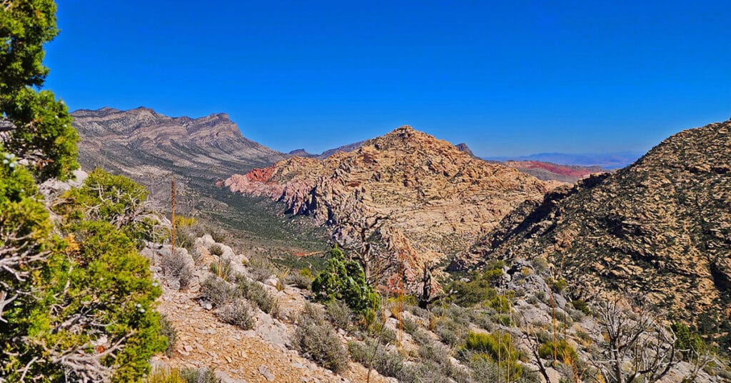
Switchback Spring is a little known, beautiful spring located in a canyon at the beginning of the first switchback stretch on Rocky Gap Road. The spring and ridge are accessed from the Willow Spring area in Red Rock Canyon, Nevada. This adventure includes a short stretch on lower Switchback Spring followed by an ascent to the high ridge above and to the South. The objective is to scope out a possible route to the summit of the Wilson Ridge above. The spring and ridge are incredibly beautiful and offer a unique perspective of the Rainbow Mountains Upper Crest Ridgeline, the La Madre Mountain Ridgeline and points in Red Rock Canyon and beyond. The best time of year for this adventure is Fall or Spring. Click the image or title above for images, videos and details…
Switchback Spring South Loop | Lovell Canyon, Nevada
Sexton Ridge Map .pdf Lovell Canyon Map .pdf Switchback Spring South Loop | Lovell Canyon, Nevada Wilderness Area Brochure .pdf Adventure Video Will Appear Here Overview | Switchback Spring South Loop | Lovell Canyon, Nevada Adventure to Occur Fall or Spring Soon! Trailhead Directions | Switchback Spring South Loop | Lovell Canyon, Nevada From I-215 […]
Switchback Spring North Loop | Lovell Canyon, Nevada
Sexton Ridge Map .pdf Lovell Canyon Map .pdf Switchback Spring North Loop | Lovell Canyon, Nevada Wilderness Area Brochure .pdf Adventure Video Will Appear Here Overview | Switchback Spring North Loop | Lovell Canyon, Nevada Adventure to Occur Fall or Spring Soon! Trailhead Directions | Switchback Spring North Loop | Lovell Canyon, Nevada Take Hwy […]
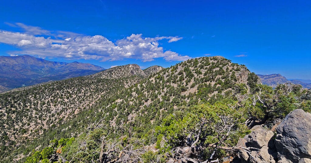
Red Rock Summit Loop | Lovell Canyon, Nevada
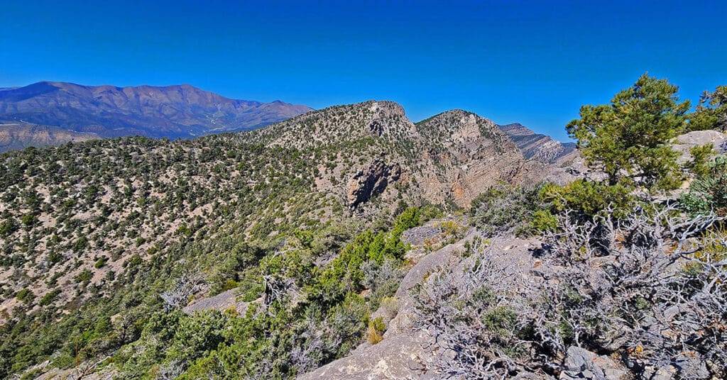
Ascend the Wilson Ridge above and North of Rocky Gap Road to Red Rock Summit. Then traverse the ridge North two high points beyond Red Rock Summit. Finally descend a long gradual approach ridge back to Lovell Canyon Road. About 95% of this adventure is pure, wild, pathless wilderness. 360-degree views along the Wilson Ridge are spectacular. There’s some complicated navigation around brush, boulders, loose rock and ledges, but nothing beyond class 2 climbing. Click the image or title above for more detail.
Mt Wilson to Juniper Peak | Rainbow Mountains, Nevada
Traverse the Rainbow Mountains Upper Crest Ridgeline in Nevada from Mt Wilson to Juniper Peak. Beginning on Lovell Canyon Road, ascend to the Upper Crest Ridgeline above Mt. Wilson, head North to the ridgeline above Juniper Peak, then descend again into Lovell Canyon. Click the image or title above for more detail.
Rocky Gap Rd to Bridge Mt Trailhead | Lovell Canyon, Nevada
Take Rocky Gap Road from Lovell Canyon Road to Bridge Mountain Trailhead. Scope out potential access to Wilson Ridge North and South. The Wilson Ridge crosses Rocky Gap Road near the summit area of that road. This area is key to completing the Wilson Ridge both North and South along with important connections to The Rainbow Mountains Upper Crest Ridgeline and the Keystone Thrust Cliffs ridge access to the La Madre Mountains. Discover the interconnection of all these ridge systems. Click the image or title above for details…
Flash Flood in Northwest Las Vegas, Nevada
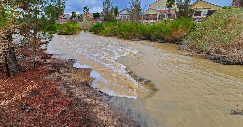
See the streaming river with cascading rapids created by a flash flood in Northwest Las Vegas, Nevada. Watch desert homes become waterfront properties! The torrent was dramatic enough to name the separate rapids and other features normally associated with a wild raging river! Click the image or title above for the entire story.
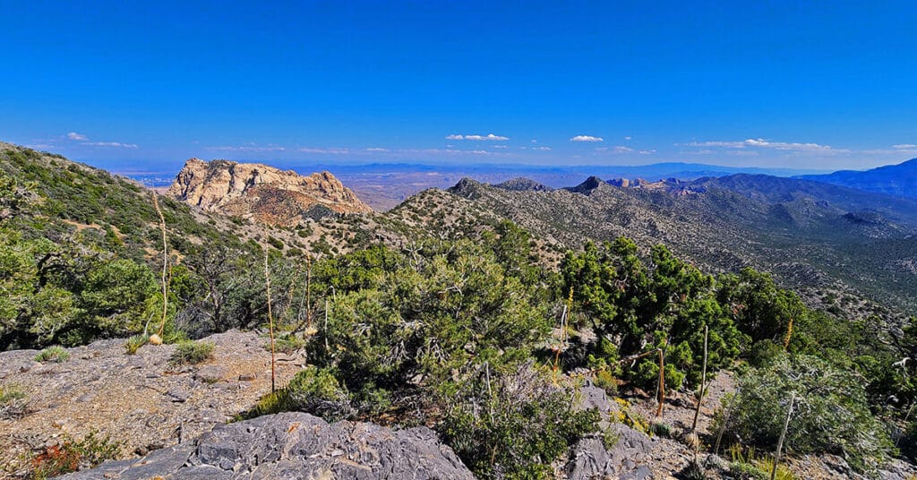
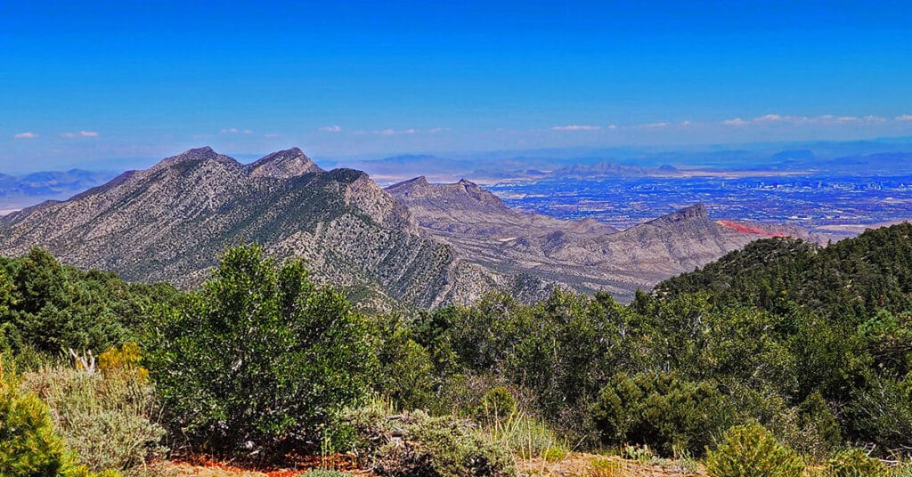
Red Rock Summit | Lovell Canyon, Nevada
Take a long, sometimes narrow and rocky approach ridge to the Wilson Ridge parallel to and above Rocky Gap Road to a prominent high point where Red Rock Summit commands the scene directly North. View the Northern and Southern stretch of the Wilson Ridge, the Northern Rainbow Mountains Upper Crest Ridgeline, Lovell Canyon, Harris and Mummy Mountains, Griffith Peak, the Las Vegas Strip and much more! Click the image or title above for more detail.
Lower Wilson Ridge Loop | Lovell Canyon, Nevada
Rare Views of an isolated stretch of the Wilson Ridge and surrounding wilderness from this unique perspective. This is a big loop beginning at upper Lovell Canyon Road, ascending to the Wilson Ridge, then traversing the ridge South to Rocky Gap Road. Best time of year for this adventure: Late Spring or Early Fall with maximum daylight at this relatively cool temperature. Click title or image for more details.
Fletcher View Ridge | Mt Charleston Wilderness, Nevada
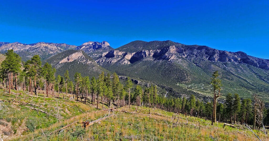
Fletcher View Ridge ascends between The Fletcher View Campground and the final summit approach to Harris Mountain. The ridge originates in The Fletcher Canyon area on Kyle Canyon Road in The Mt. Charleston Wilderness, Nevada. Expect non-stop spectacular views of the highest peaks on The Mt. Charleston Loop along with a good aerial view of Fletcher Canyon and potential route to Fletcher Peak summit. Elevation: 7,000-9,000ft. wilderness route, no trails or trail signs. Best time of year for this adventure: July through September. Click the image or title above for details.