La Madre Mountains Wilderness, Nevada
La Madre Mountain South Approach: 22 mi / 4306-8000ft *Wilderness, No Trail*
La Madre Mountains Wilderness, Nevada
La Madre Mountain North Approach: 25 mi / 4500-8000ft **Road + Wilderness**
La Madre Mountains Wilderness, Nevada
La Madre Mountain West Approach: 28 mi / 4306-8000ft *Wilderness, No Trail*
La Madre Mountains Wilderness, Nevada
La Madre Mountain East Approach: 28 mi / 4306-8000ft **Wilderness, No Trail**
La Madre Mountains Wilderness, Nevada
High Elevation Perspective: 20 mi / 4500-7000ft **Road + Wilderness**
La Madre Mountains Wilderness, Nevada
La Madre, El Padre, Burnt Peak: 25+ Miles RT / 4500-8,500ft **Mostly Wilderness**
La Madre Mountains Wilderness, Nevada
Burnt Peak: 20 Miles + RT / 4500-7900ft **Some Road, Mostly Wilderness**
La Madre Mountains Wilderness, Nevada
El Padre Mountain: 24 mi / 4500-7500ft **Some Road, Mostly Wilderness**
La Madre Mountains Wilderness, Nevada
Kyle Canyon Grand Crossing North: 20 Miles RT / 4500-7900ft *Road + Wilderness*
La Madre Mountains Wilderness, Nevada
Lovell Canyon Overview
Southern Summit Approach | La Madre Mountains Wilderness, Nevada | Overview Northern Summit Approach | La Madre Mountains Wilderness, Nevada | Overview Western Summit Approach | La Madre Mountains Wilderness, Nevada | Overview Eastern Summit Approach | La Madre Mountains Wilderness, Nevada | Overview High Elevation Perspective | La Madre Mountains Wilderness, Nevada | Overview La Madre Mt, El Padre Mt, Burnt Peak Circuit | La Madre Mountains Wilderness, Nevada | Overview Burnt Peak | La Madre Mountains Wilderness, Nevada | Overview El Padre Mountain | La Madre Mountains Wilderness, Nevada | Overview Kyle Canyon Grand Crossing Northern Half | La Madre Mountains Wilderness, Nevada | Overview Lovell Canyon Trail | Lovell Canyon | La Madre Mountains Wilderness, Nevada

La Madre Mountains Wilderness Overview

(Click Through to Individual Trails and Wilderness Routes Below)

(Mileage Below is Round Trip. Altitude and Mileage are Approximate)

La Madre Ridgeline East to West

East La Madre Peak

About 12 Miles RT / 4500-7,000ft
*Some Road, Some Wilderness*

La Madre Mountain North Approach

25 mi / 4500-8000ft
*Some Road, Mostly Wilderness*

La Madre Mt, El Padre Mt, Burnt Peak

25+ Miles RT / 4500-8,500ft
*Some Road, Mostly Wilderness*

El Bastardo Peak

17.5 mi / 4500-7872ft
*Half Roads, Half Wilderness*

La Madre Ridgeline Grand Crossing

Approx.  20-25 mi.  
**Some Trails, Some Roads, Mostly Wilderness**

La Madre Mountain West Approach

28 mi / 4306-8000ft
*Wilderness, No Trail*

Additional Adventures on the La Madre Ridgeline

Burnt Peak

20 Miles + RT / 4500-7900ft
*Some Road, Mostly Wilderness*

El Padre Mountain

24 mi / 4500-7500ft
*Some Road, Mostly Wilderness*

La Madre Mountains High Elevation Perspective

20 mi / 4500-7000ft
*Some Road, Mostly Wilderness*

La Madre Mountain East Approach

28 mi / 4306-8000ft
*Wilderness, No Trail*

Southern La Madre Mountains Wilderness, Nevada

La Madre Ridgeline Grand Crossing

Approx.  20-25 mi.  
**Some Trails, Some Roads, Mostly Wilderness**

Kyle Canyon Grand Crossing North

20 Miles + RT / 4500-7900ft
*Some Road, Mostly Wilderness*

Kyle Canyon Grand Crossing South

15 Miles + RT / 4500-7600ft
*Trails + Wilderness*

La Madre Mountain South Approach

22 mi / 4306-8000ft
*Wilderness, No Trail*

Keystone Thrust Summit from Willow Spring

15 Miles + RT / 4500-7500ft
*Trails + Wilderness*

3-Basin Circuit Trails

Approx.  28 mi.  
**Good Trails/Sketchy Trails/Wilderness**

Brownstone Trail

Approx. 26mi RT | 3,600-6,400ft Elevation |  **Excellent Trail for
Hiking or Running!**

Gray Cap Ridge Brownstone Loop

**10-12 Miles, 3,710 – 5,400ft Elevation **

Gray Cap Ridge SE Summit

Approx. 10mi RT | 3,500-5,000ft Elevation |  **Good Unmarked Trails, Pathless Final Approach**

Switchback Spring Ridge

5 Miles + RT / 4600-6400ft
*Unpaved Road + Wilderness*

Switchback Spring Loops Intro

5 Miles + RT / 4200-6040ft
*Unpaved Road + Wilderness*

Damsel Peak

Damsel Peak North Summit

16 mi Start Sandstone Quarry Red Rock | 4370 > 6977ft
**Wilderness, No Trail**

Damsel Peak
Southeastern Slope

14 mi Start Kraft Mt. Trailhead Parking | 3800 > 6700ft
**Trails, Roads, Wilderness**

Damsel Peak South Approach

Approx 15 mi RT
**Trails, Roads, Wilderness, Some Class 3 Climbing**

(Adventure In Process)

Damsel Peak Loop

Approx 30 mi.; 3,600 – 6,530ft elevation;
**Trails, Roads, Wilderness, Some Class 3 Climbing**

Damsel Peak Southeastern Pinnacle Loop | La Madre Mountains Wilderness, Nevada

Damsel Peak SE Pinnacle Loop

Approx.  6-7 mi.  
**Some Roads, Mostly Wilderness**

Damsel Peak End-To-End | Brownstone Basin, Nevada

Damsel Peak End-to-End

Approx.  16-17 mi.  
**Some Roads, Mostly Wilderness**

Exploring Potential Routes to La Madre Mountain Summit

Imaging North, South, East & West La Madre Mountain Approaches

La Madre Mountains Wilderness, Nevada

Where is La Madre Mountains Wilderness?

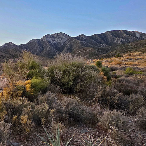
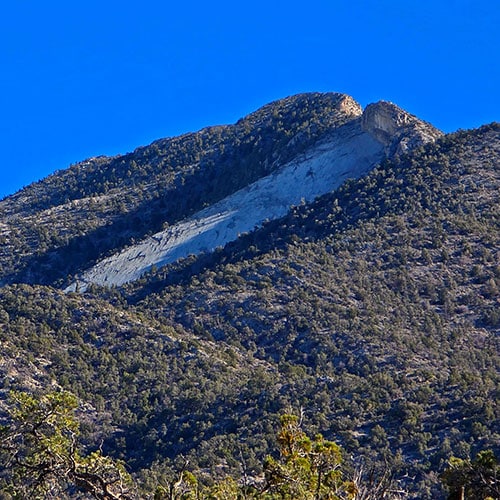
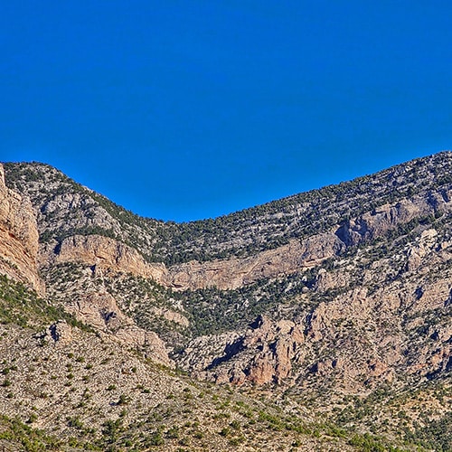
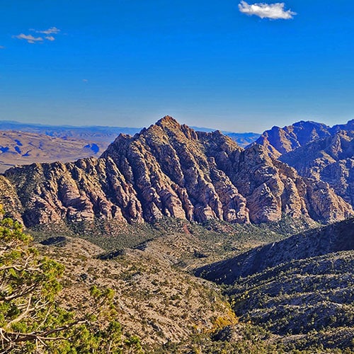
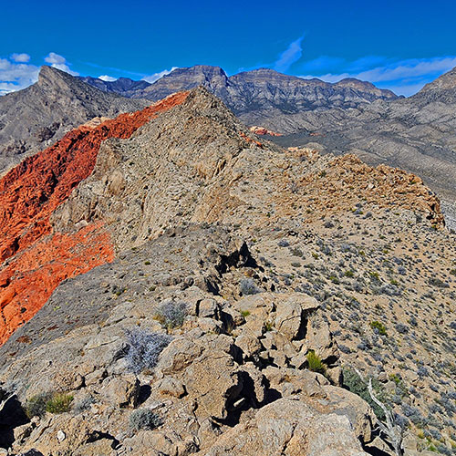
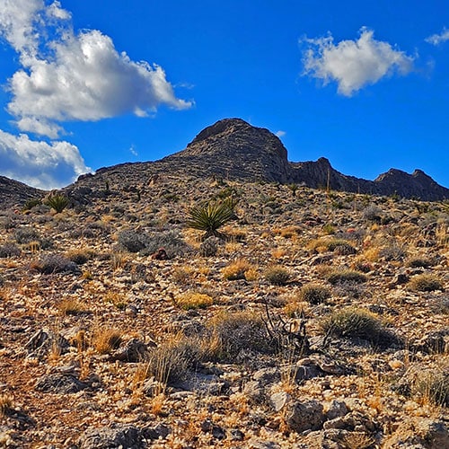
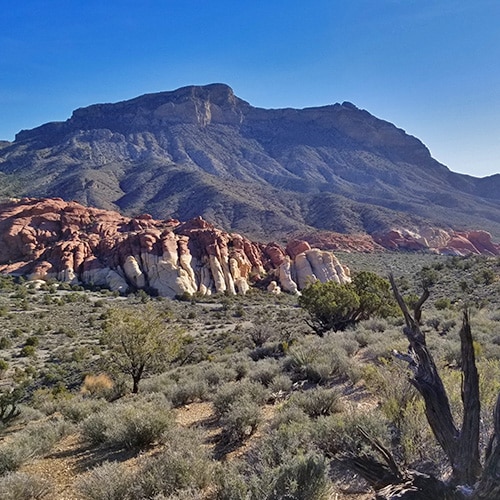
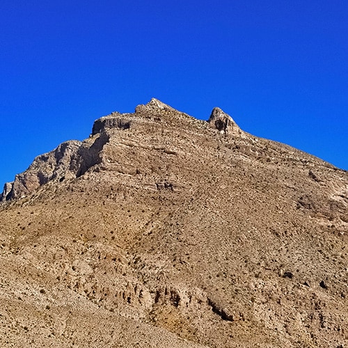
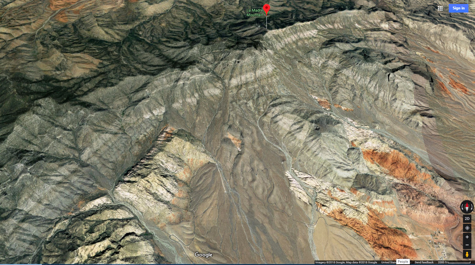
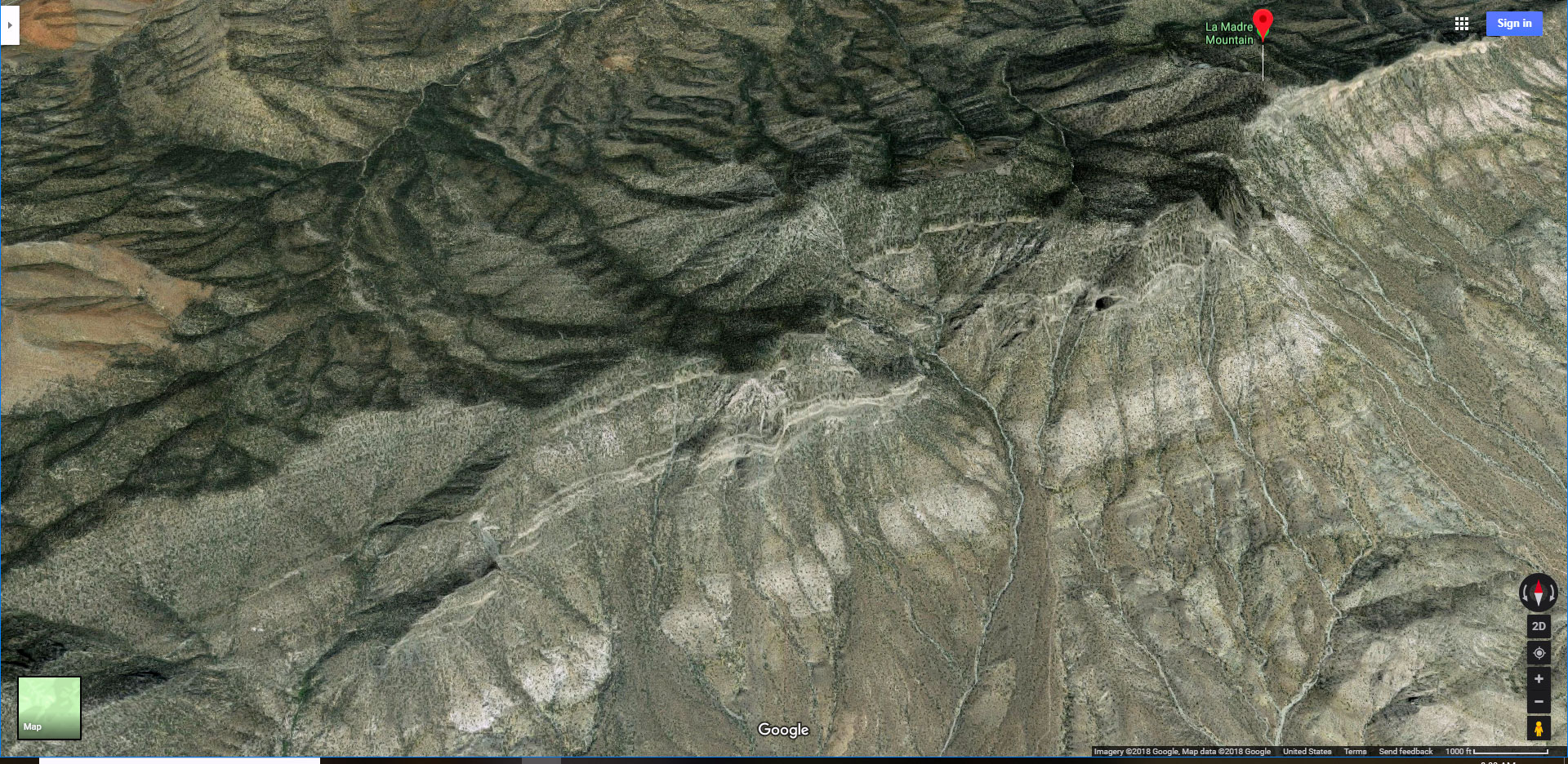
La Madre Mountains Wilderness in Nevada is largely unknown to the general public. It is overshadowed by its more popular neighbor to the Southwest, Red Rock Canyon. This is puzzling because La Madre Mountains Wilderness is 4 times the size of Red Rock Canyon and immediately visible to anyone riding the Red Rock Canyon NCA scenic loop. As you enter Red Rock Canyon’s Scenic Drive and look directly across to the upper boarder of the park, you will see a huge cliff spanning the upper boarder of Red Rock Canyon and also forming the upper boarder of the neighboring Calico & Brownstone Basins. This cliff is a geological formation called “The Keystone Thrust”. One could also refer to it as The La Madre Ridgeline. The highest elevation on the La Madre Ridgeline is La Madre Mountain. The La Madre Ridgeline spans East to West stretching from the edge of the Las Vegas Metro area to the Wilson Ridge over Lovell Canyon. La Madre Mountain itself, at 8,000ft is about 1,800ft higher than the better-known Turtlehead Peak in Red Rock Canyon NCA.

North Side of the La Madre Ridgeline

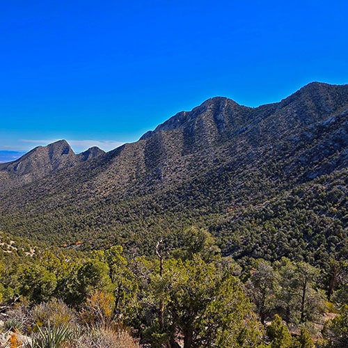
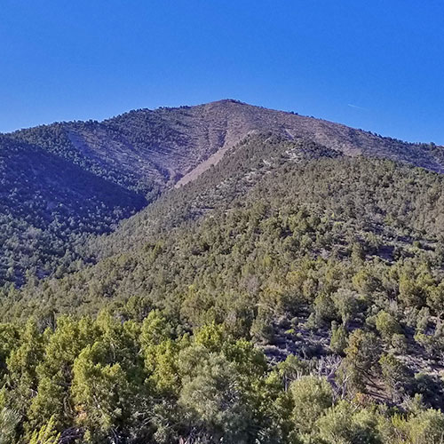
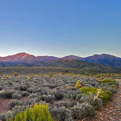
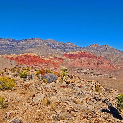
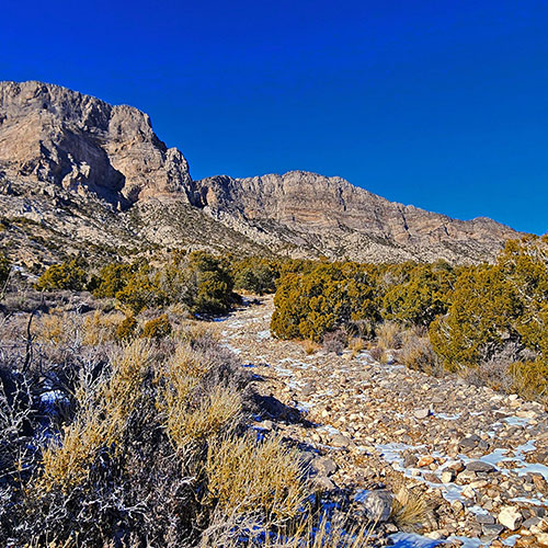
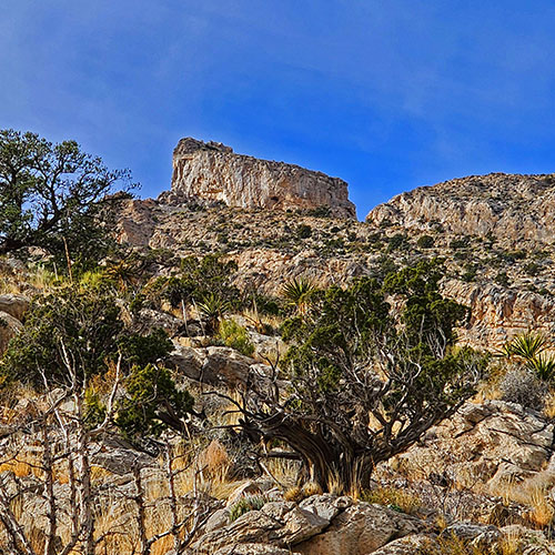
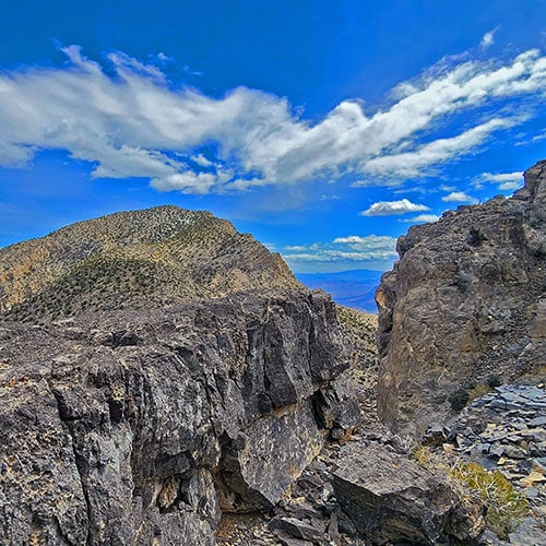
When you to stand on the summit of the La Madre Ridgeline and look beyond to the North you are looking down on Kyle Canyon, the approach canyon to the Mt. Charleston Wilderness and the canyon at its center. The slope on the Kyle Canyon side of the La Madre Ridgeline is a bit gentler  than the sheer cliff on the Red Rock side. In addition, La Madre Mountains Wilderness, on the Kyle Canyon side is a lush pine and juniper forest in contrast to the stark desert landscape in Red Rock Canyon. Thus, each side of the La Madre Ridgeline looks like its own different world. La Madre Mountains Wilderness is largely untouched, approached only by 4-wheel drive and by foot. You can spend an entire day wandering around this huge, peaceful wilderness and not see a soul.

Routes to La Madre Mountain

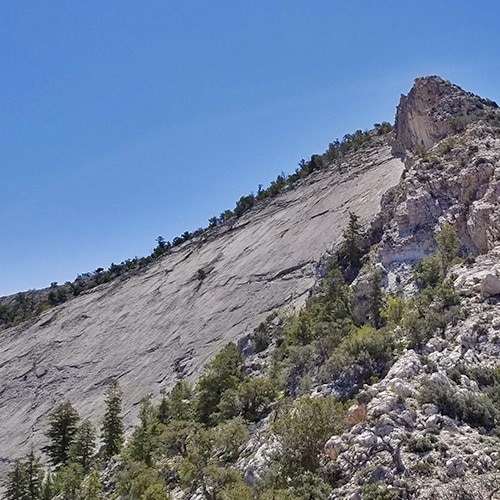
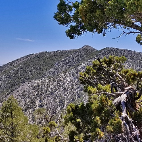
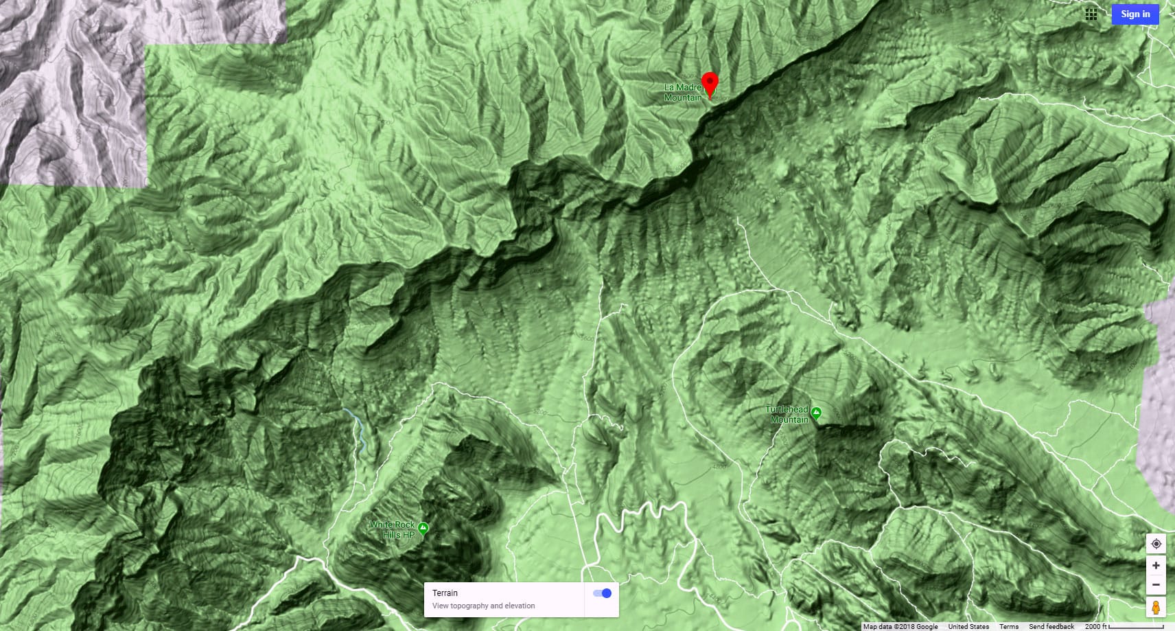
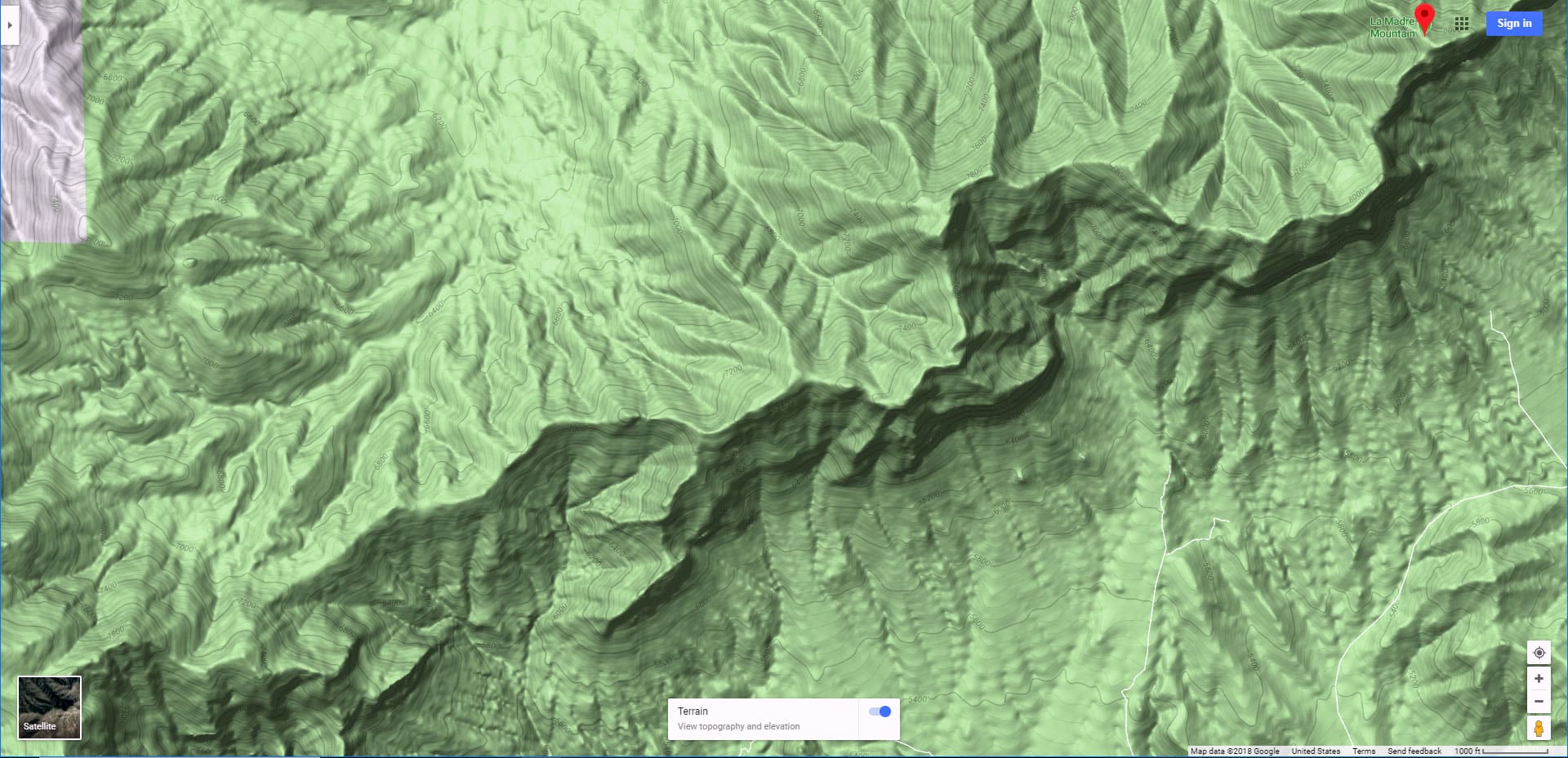
La Madre Mountain itself is only accessible by 4-wheel drive and by foot. I’ve approached La Madre Mountain from the North, South, East and West. From the North you’re looking at about 8 miles of unpaved roads beginning at the intersection of Kyle Canyon Road and lower Harris Springs Road followed by 3 miles of a faint trail to the summit of La Madre Mountain, a 22 mile round trip. From the West you’re looking at about 12 miles of trails and wilderness beginning at the Willow Springs picnic area in Red Rock Canyon NCA, then continuing up to the La Madre Mountain Springs area, then on up to the summit of the La Madre Ridgeline, take a right and traverse the top of the La Madre Ridgeline to La Madre Mountain, a 24-mile round trip. From the South you’re beginning at the Sandstone Quarry (Turtlehead Peak) parking area in Red Rock Canyon, NCA, ascending the Red Rock Wash, circling around to the upper Calico Basin then ascending the cliff/”Notch” between El Padre and La Madre Mountains, an 18-mile round trip with a lot of loose rock cliff scrambling. From the East you’re following a similar route but crossing the upper Calico Basin to ascend the ridge upon which Damsel Peak sits, then circling that ridge to the East to ascend La Madre Mountain from the far side, a 22-mile round trip.

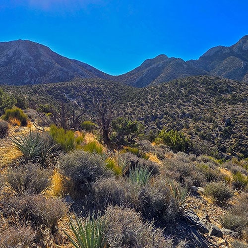
Pristine, Hidden Wilderness

As you can see, La Madre Mountain sits in the middle of a vast wilderness requiring no less than a 22-mile round trip, most of which is inaccessible by motor vehicle. Yet, La Madre Mountain’s inaccessibility is its strength, making for a peaceful wild adventure! It helps being a trail runner in order to cover these long distances. Otherwise, you may want to prepare for a 2-day adventure. The amazing thing is that during the entire trip you’re only about 25-30 miles from the Las Vegas Strip and about 15-20 miles from residential Las Vegas!

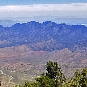
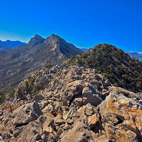
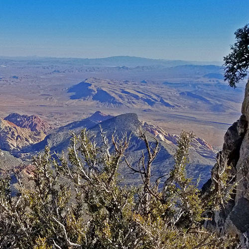
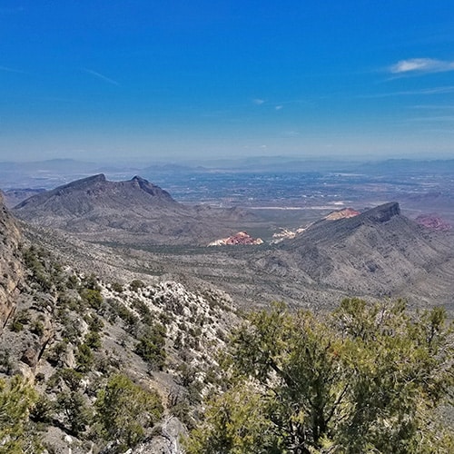
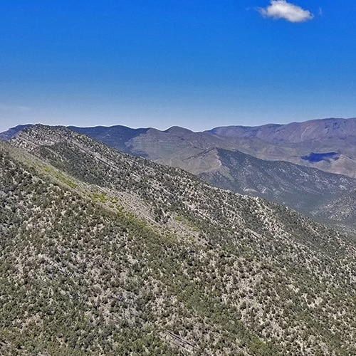
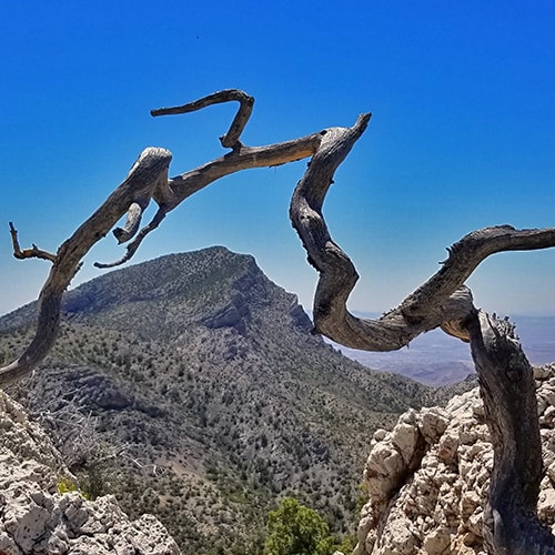
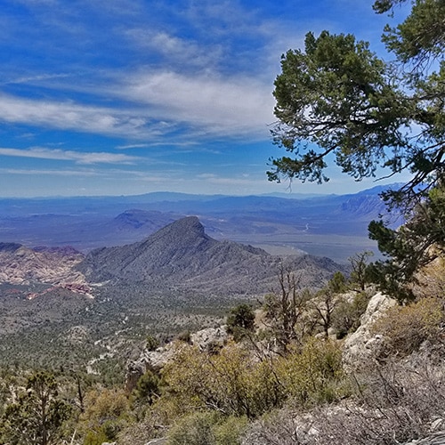
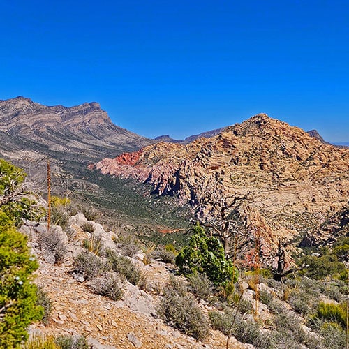
Spectacular Views from La Madre Mt. and the La Madre Ridgeline

And then, there’s the view from the La Madre Mountain summit, and from much of the approach route. You can see in all its glory the Mt. Charleston Wilderness, Red Rock Canyon and Calico Basin, the Sheep Range, Gass Peak and other points of interest in the further distance.

Additional Projected Adventures

Switchback Spring Loops North & South (Completing the West end of the La Madre Ridgeline)

Keystone Thrust Trail Complete

Legendary La Madre Mountains Loop (Traverse the entire La Madre Ridgeline in a single adventure.)

Summary
La Madre Mountains Wilderness, Nevada | Overview
Article Name
La Madre Mountains Wilderness, Nevada | Overview
Description
The La Madre Mountains Wilderness of Nevada is huge, stretching from the West side of the Las Vegas Valley all the way into Lovell Canyon at the base of Griffith Peak. Follow thumbnail images on this page to view individual adventures in the La Madre Mountains Wilderness.
Author
Publisher Name
LasVegasAreaTrails.com
Publisher Logo
Translate »