Switchback Spring Loops Intro | La Madre Mountains Wilderness, Nevada
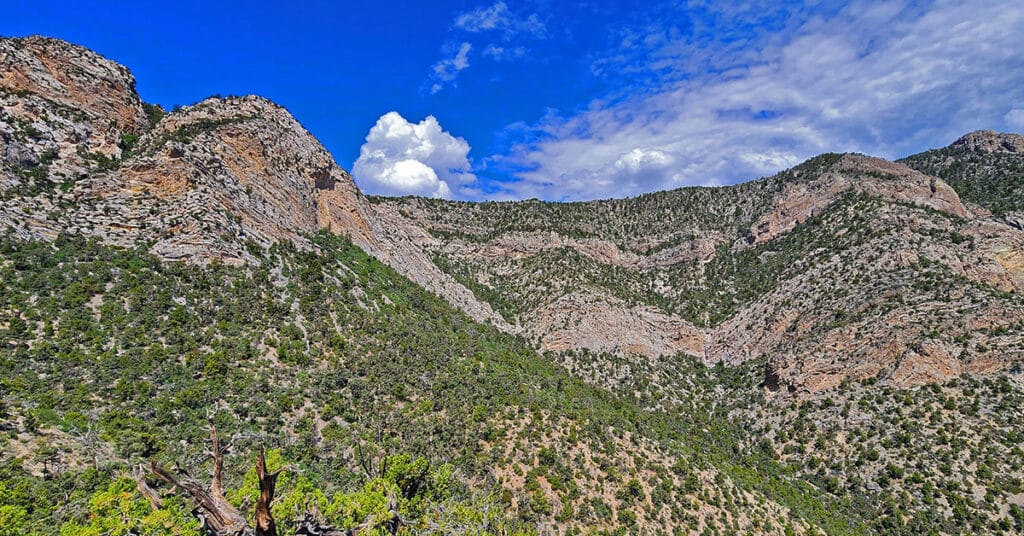
The Switchback Springs North and South Loops in the La Madre Mountains Wilderness deliver an experience of 3 great ridge systems in Southern Nevada: 1. The La Madre Mountains Ridge; 2. The Wilson Ridge; 3. The Rainbow Mountains Upper Crest Ridgeline. Overview the routes of both loops along with how to access the loops from Willow Spring in Red Rock Canyon. Click the image or title above for details.
La Madre Springs West Ridge Loop | La Madre Mountains Wilderness, Nevada
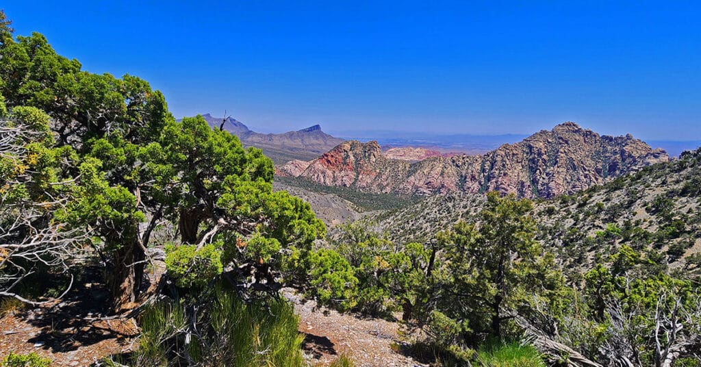
This hike makes the beautiful Juniper and Pine zone in the La Madre Mountains Wilderness closer and more accessible, including expansive views of terrain from the Wilson Ridgeline to the Rainbow Mountains to Red Rock Canyon, the Brownstone Basin and all the way to the Las Vegas Strip and beyond! Click the image or title above for details.
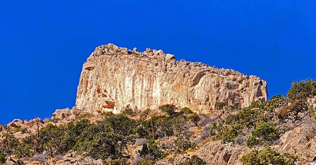
El Bastardo Peak | La Madre Mountains Wilderness, Nevada

From Red Rock Canyon, El Bastardo Peak, a high point on the La Madre Ridgeline appears to be a vertical cliff. Learn how to walk to the summit from Kyle Canyon on the opposite side! Click the image or title above for details.
Damsel Peak Southeastern Pinnacle Loop | La Madre Mountains Wilderness, Nevada
Ascend the massive SE canyon and ridgeline of Damsel Peak to a spectacular limestone formation seen from most points throughout the Las Vegas Valley below. You’re ascending along the edge of huge limestone plates that were once the bottom of an ancient sea floor. Click the image or title above for details.
Harris Springs Canyon Ridgeline | La Madre Mountains Wilderness, Nevada

Harris Springs Canyon Ridgeline is right on the edge of the Las Vegas Metro Area making this an awesome convenient location for hiking, mountain biking, climbing and wilderness exploration. It’s like a remote wilderness experience at the edge of Las Vegas, and the views are spectacular! Click the image or title above for details.
La Madre Ridgeline Grand Crossing | La Madre Mts. Wilderness & Red Rock Canyon NCA, Nevada

Navigate from Kyle Canyon Road to the summit of the La Madre Mountains Ridgeline, then descend to the entrance of Red Rock Canyon in Nevada. You’ll experience two unique worlds bordering one spectacular ridgeline during this 25-mile + wilderness adventure. Click the image or title above for details.
Gateway Canyon & Gray Cap Ridge NW | Calico Basin, Nevada

Wander through a unique, hidden world in the Northwest area of Gray Cap Ridge. Gateway Canyon will whirl you around and by the time you emerge into the Northwest area of Gray Cap Ridge you may wonder if you’d landed in another dimension! Finding a non-vertical way down into the Brownstone Basin can be a real puzzle, but great fun. Click the image or title above for details.
Red Cap Peak Summit | Red Rock Canyon NCA, Nevada
Red Cap Peak, also referred to as “Little Turtlehead”, is a Jurassic Era Sandstone Summit in Red Rock Canyon National Conservation Area, Nevada. This adventure begins at the Kraft Mountain Trailhead in the Calico Basin and navigates through Ash Canyon before summiting the peak. The best time of year for this adventure is Spring and Fall. Click the title or image above for more details.
Gray Cap Ridge Brownstone Basin Loop | La Madre Mountains Wilderness, Nevada

Beginning at Gene’s Trailhead in the Calico Basin, traverse most of Gray Cap Ridgeline from the SE Summit, then return to the Calico Basin by way of the Brownstone Trail and Road. Best time of year for this adventure is Spring or Fall. Click the image or title above for all the details.
Gray Cap Ridge Southeast Summit | La Madre Mountains Wilderness, Nevada

Gray Cap Ridge Southeast Summit in Nevada is an easy hike with spectacular views. Trails get you nearly to the summit. Hike begins at Gene’s Trailhead in the Calico Basin and navigates to the summit in the La Madre Mountains Wilderness. Best time of year for this adventure is Spring or Fall. Click the image or title above for more details.