Overview | La Madre Mountain North Ridge | La Madre Mountains Wilderness, Nevada
This is a Northern approach ridge toward La Madre Mountain summit beginning on lower Kyle Canyon Road. Below the summit of the ridgeline the route meets up with an earlier approach made from the La Madre Mountains campground: https://lasvegasareatrails.com/la-madre-mountain-northern-approach/ The North Ridge approach ascends the West side of Devil’s Slide, then circles above and around to La Madre Mountain’s summit.
Unique Features on the La Madre Mountain North Ridge Route
This route offers the following unique features:
- Ancient limestone sea bottom slabs embedded with endless fossils.
- Lower Harris Canyon Wash
- Eastern La Madre Mountain Ridgeline approach valley.
- Terrain change from barren lower desert to Juniper and Pinyon Pine zone.
- Nice gradual approach slope toward La Madre Mountain summit…though with a relentless incline!
- Opportunity to experience some class 3 rock scrambling if you want. But you need not venture beyond a class 2 walk.
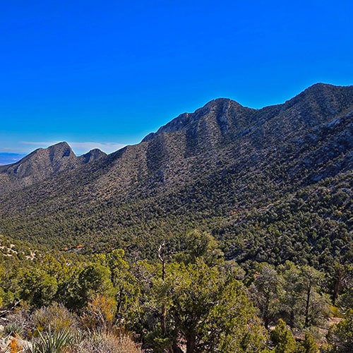
Unique Views from La Madre Mountain North Ridge
As you ascend the North Ridge the surrounding wilderness views continually expand. It’s like being on a mountaintop the entire way! Here are a few sights:
Level of Difficulty on La Madre Mountain North Ridge
It’s all a class 2 walk unless you want to descend through the limestone ledges on the East side of the North Ridge and experience some light class 3 rock scrambling.
Best Time of Year to Visit La Madre Mountain North Ridge
Visit in the Fall or Spring months when temperatures in the Las Vegas Valley are predicted to reach a high around 80 degrees. In the Fall, visit before the first significant snowfall. In the Spring allow time for the snow at the 8,000ft altitude to melt or risk icy conditions. Summer can bring dangerously high temperatures on the approach route and even the higher elevations. Winter can bring treacherous icy conditions on the upper limestone ledges and slopes.
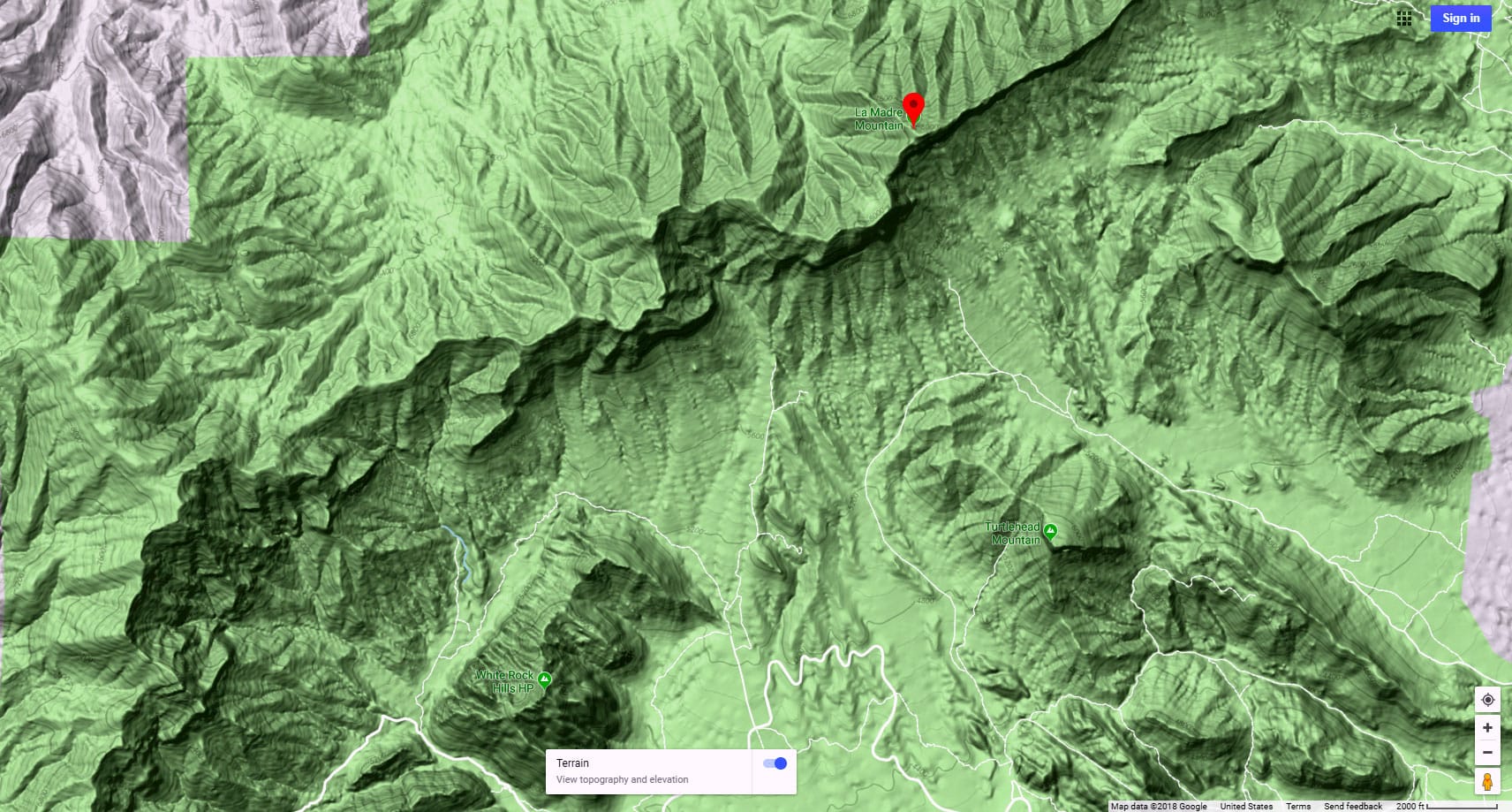
Directions to Route Starting Point | La Madre Mountain North Ridge | La Madre Mountains Wilderness, Nevada
This adventure reaches the North Ridge of La Madre Mt. from a parking area on Kyle Canyon Road to the North. Take Hwy 95 North from Las Vegas. Exit left onto Kyle Canyon Road toward Mt. Charleston (around the end of the Northern metro area). In about 3 miles, shortly beyond the edge of the housing and horse ranch area, watch for a small trailhead parking area on the left (South) side of Kyle Canyon Road.
Narrative Guide | La Madre Mountain North Ridge | La Madre Mountains Wilderness, Nevada
Getting Your Initial Bearings
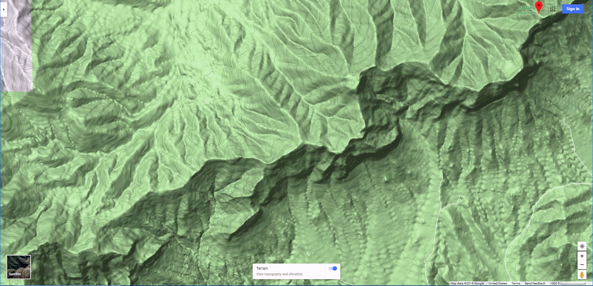
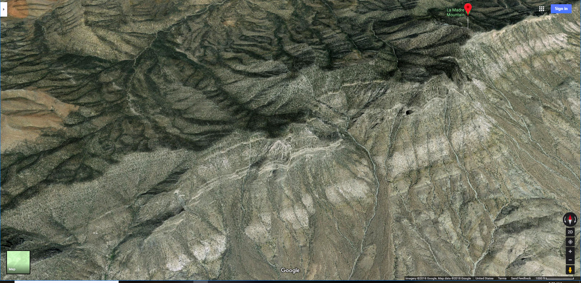
From the parking area you can make out your general route. To the South on the horizon the tip of the Eastern stretch of the La Madre Ridgeline can be seen just above the intervening ridgeline. That’s your ultimate goal. Just South of the parking area lies the huge Harris Springs Wash. To your left (Southeast) is the Harris Springs Canyon Ridgeline with Peak 6080 as its high point. Your route will be to cross Harris Springs Canyon, then angle left (Southeast) over to ascend the valley along the base of Harris Springs Canyon Ridgeline. Then take a right along the La Madre Mountains Eastern Ridgeline Baseline Wash. Finally, take a left at the end of that wash to ascend the La Madre Mountain North Ridge.
Parking Area to the Approach Valley Along the Base of Harris Springs Canyon Ridgeline
Follow the old road leading South from the parking area toward Harris Springs Canyon Wash. The road angles left, then descends into the wash. Head down the wash (left/East), watching for a low point to ascend the opposite side of the wash. Pick out your best route. There are no trails and the crossing can be complicated. Once you ascend to the ridge on the opposite side of the wash, turn left on a trail that will bring you down into the valley at the base of Harris Springs Canyon Ridgeline. Once in the valley, the trail will connect with an unpaved road that will guide you up the valley and toward the now visible La Madre Mountains Eastern Ridgeline.
La Madre Mountains Eastern Ridgeline Baseline Wash
Near the end of the valley as the road forks off to the left, take a right (West) into the wash that runs along the base of the La Madre Mountains Eastern Ridgeline. Though the wash is a bit more complicated to navigate than the unpaved road, it’s still fairly wide and easy. The gravel surface gets deep in places and the wash winds around so you’re continually picking out your best route. I found the best route favors the right side of the wash along the base of a ridgeline there.
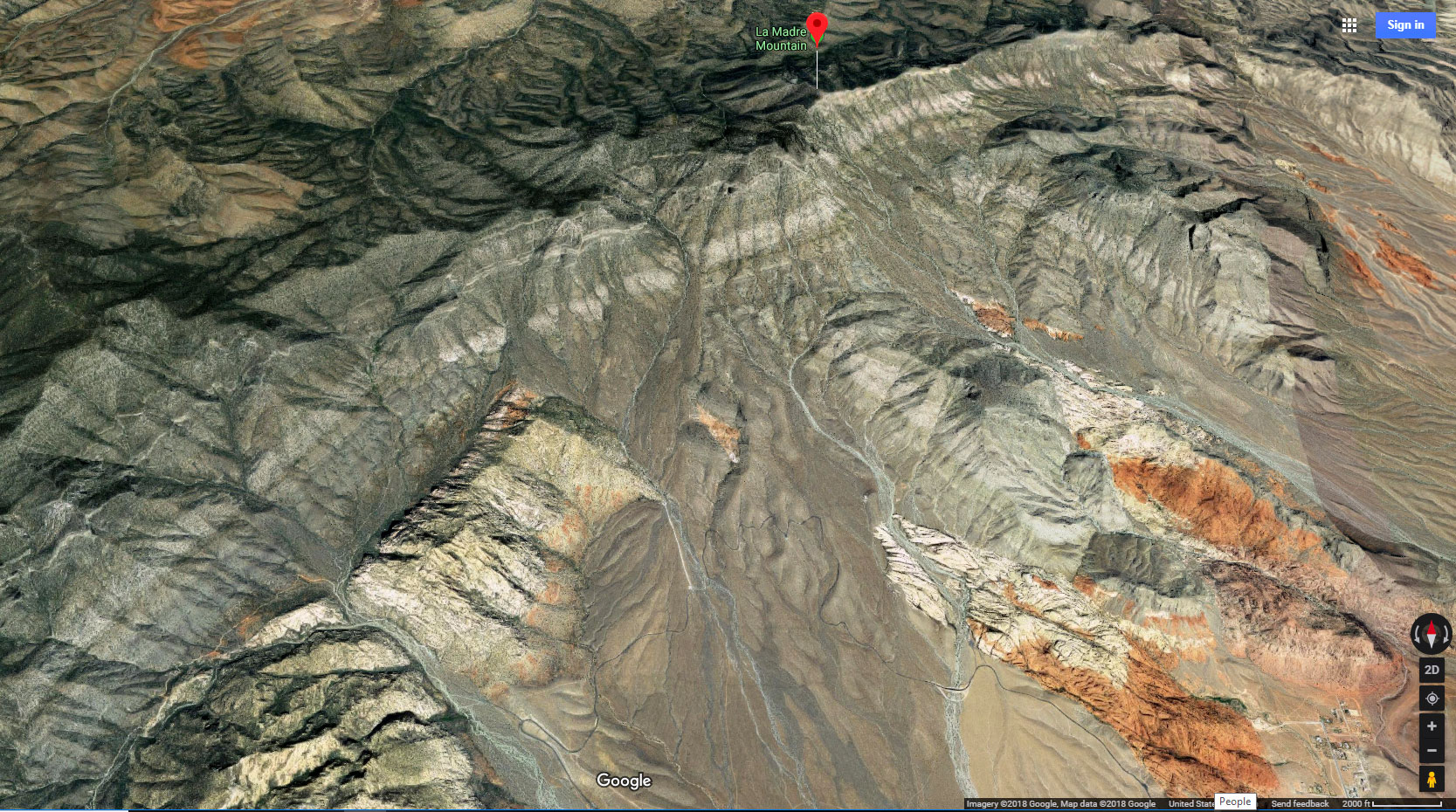
Eventually, the Northern Approach Ridgeline toward La Madre Mountain appears ahead. As you continue up the wash, the surface becomes larger limestone boulders and eventually a beautiful limestone slab. The wide limestone surface is an ancient 400M+ year-old sea bottom. You can almost imagine the ancient sea rippling over the now frozen and solidified muddy sea bottom. Ancient sea creatures died and sank into the mud. Their shells provided the calcium that glued and froze the mud into limestone. Look closely to see the limestone slab embedded with fossils!
Ascending the La Madre Mountain North Ridge
Not far beyond the limestone slab the wash narrows and the walls become higher and more vertical. Watch for an exit route over the left side of the wash before the walls become too high. Once above the left (South) side of the wash head to the lower edge of the gradual La Madre Mountain North Ridge. Begin ascending the ridge, watching for more fossils embedded in the limestone blocks along the ridge! I favored the outer left side of the ridge where the views are best and the ascent route easiest. However, you’ll end up winding upward along the ridgeline continually seeking out a best route. As you ascend the ridge the terrain makes a dramatic change from stark barren desert to a Pinyon Pine and Juniper forest.
There are a number of high points along the ridge, so the ascent is a matter of going from one high point to the next. Once on the first large high point marked with limestone ledges on its East side, La Madre Mountain and its ridgeline appear, with Devil’s Slide the huge feature. Look all around to see the spectacular views listed above!
Alternate Descent Route
On this day, I turned around shortly before the North Ridge met up with a route I had taken earlier to La Madre Mountain’s summit from the La Madre Mountains Campground below to the West: https://lasvegasareatrails.com/la-madre-mountain-northern-approach/ I descended the North Ridge back to its initial rocky high point. From there, the old road heading East on the slopes below was visible. It took some class 3 rock scrambling to weave down through the limestone ledges toward the old road. There is no significant exposure depending on the route you take.
Eventually reach the old road below. Now the remainder of your route is streamlined by roads. The upper portion of the road has been blocked off to motor vehicles, so is a bit grown over in places, but still a solid, fast descent route. Lower, at the vehicle barrier there is a brand new La Madre Mountains Wilderness entrance sign and a parking area that could be used as a camping base for exploring the entire Eastern ridgeline. Beyond the barrier, the road is fairly well graded and well used, further streamlining progress. At this point you’re heading East, parallel to the approach wash you took earlier and not far above the wash. The road is a lot faster than the wash, but missing all the beautiful limestone and fossils!
Take a left at the base of Harris Springs Canyon Ridgeline and retrace your route back to the parking area on Kyle Canyon Road.
Summary
This route toward and up the La Madre Mountain North Ridge is an excellent way to scope out further adventures on the summit of the La Madre Mountains Ridgeline and its many approach ridgelines. It’s a beautiful, interesting route with many discoveries along the way. Make the adventure as short or as long as you want; as easy or as complicated as you like. Just be sure to have a turn-around point so you don’t end up on the La Madre Ridgeline or the North Ridge in the dark!


