Blue Diamond Hill Southern Canyons, Nevada
Explore a few of the 7 little-known deep, majestic canyons in the southern area of Blue Diamond Hill in Nevada. Starting at Wheeler Camp Spring trailhead parking on Hwy 159, begin exploring canyons South of the Blue Diamond Hill Gypsum Mining Road. The best time of year for this adventure is Fall through Spring. Click the image or title above for more details.
Blue Diamond Hill Southern Ridgelines, Nevada

Enjoy non-stop eagle-eye views of the entire Rainbow Mountain range from a Southern perspective while simultaneously surrounded by majestic canyons! This little-known Southern wilderness area on Blue Diamond Hill is across highway 159 from the town of Blue Diamond. Click the image or title above for more details.
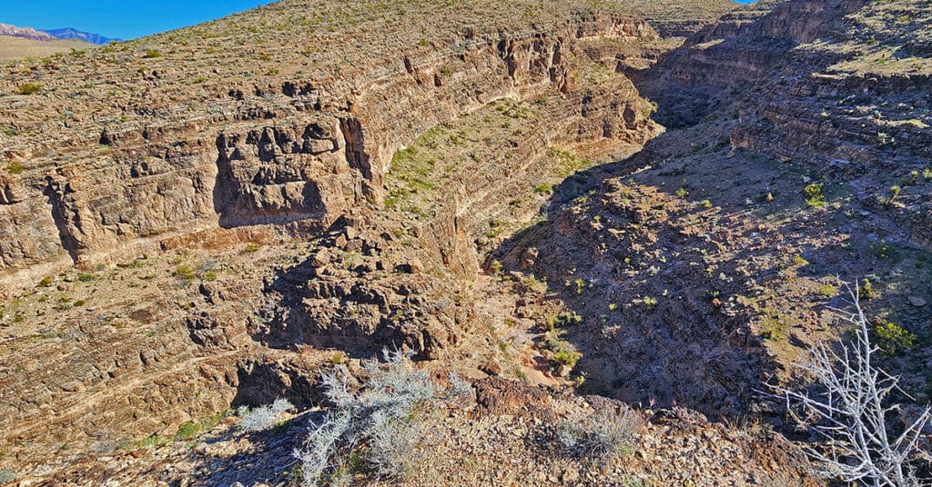
Fossil Canyon | Cowboy Canyon | Blue Diamond Hill, Nevada

Experience two huge, wild canyons in Blue Diamond Hill just outside of Las Vegas, Nevada. Navigate the full length of these canyons through trails and stretches of pathless wilderness. Discover ancient fossils and enjoy spectacular views of Red Rock Canyon and the Rainbow Mountains framed by towering cliff walls. Best time of year for this adventure: Fall through Spring. Click the image or title above for more details.
Gray Cap Ridge Brownstone Basin Loop | La Madre Mountains Wilderness, Nevada

Beginning at Gene’s Trailhead in the Calico Basin, traverse most of Gray Cap Ridgeline from the SE Summit, then return to the Calico Basin by way of the Brownstone Trail and Road. Best time of year for this adventure is Spring or Fall. Click the image or title above for all the details.
Nevada Wilderness Finder

Identify official wilderness areas and wilderness boundaries throughout the State of Nevada. Drill down for a basic introduction to each wilderness area.
Brownstone Trail | Calico Basin | Brownstone Basin | La Madre Mountains Wilderness, Nevada

The Brownstone Trail adventure spans Nevada’s Calico Basin, Brownstone Basin and La Madre Mountains Wilderness. Along the way, there are spectacular views of the La Madre Mountains Ridgeline, Damsel Peak, the Las Vegas Valley and Strip and the Jurassic Era calico sandstone Gray Cap Ridge. Click the image or title above for more detail.
Calico Basin Daily Workout Trails | Calico Basin, Nevada

This extensive network of trails in the lower Calico Basin, Nevada, is an awesome setting for daily conditioning workouts whether your sport is hiking, trail running or mountain biking. The trail system is just a few miles from metropolitan Las Vegas, making access convenient. Work out year-round in a natural setting on a healthy running surface. Build strength, endurance, flexibility and agility! Click the image or title above for more details.
Upper Calico Hills Loop | Calico Basin & Red Rock Canyon National Conservation Area, Nevada

This spectacular 6-mile loop combines 6 or more trails to circle the upper Calico Hills in Red Rock Canyon & Calico Basin, Nevada. The trail passes through two beautiful wild passes in the Calico Hills: Ash Canyon and the mid-Calico Hills Black Corridor Pass. Click the image or title above for all the details.
3 Basin Circuit | Red Rock Canyon, Nevada

Experience 3 incredible Southern Nevada wilderness areas in one great adventure. This circuit begins in the Calico Basin, rounds the South side of the Calico Hills, heads North to upper Red Rock Canyon, circles over to Brownstone Basin then finally descends to the starting point in Calico Basin. Click the image or title above for more details.
Lovell Canyon Ridgelines | Lovell Canyon, Nevada

Lovell Canyon’s surrounding ridgelines create both a majestic and an intimate feeling. The ridgelines majestically tower over the canyon while enclosing it in its own unique setting. There’s the Wilson Ridgeline (East Side); Sexton Ridgeline (West Side); Griffith/Harris Saddle (North side); and The Rainbow Mountains Upper Crest Ridgeline (Southeast Region). From 5,000-11,000ft in elevation, the ridgelines offer spectacular views of Lovell Canyon and its surrounding wilderness areas. Click the image or title above to learn more.