Potosi Mine and Tram | Potosi Mountain, Nevada
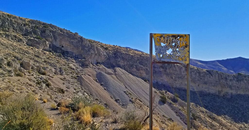
Visit Nevada’s oldest mining operation dating back to 1855. Click the image or title above for details.
Blue Tree Loop Trail | Sawmill Trailhead | Lee Canyon, Nevada
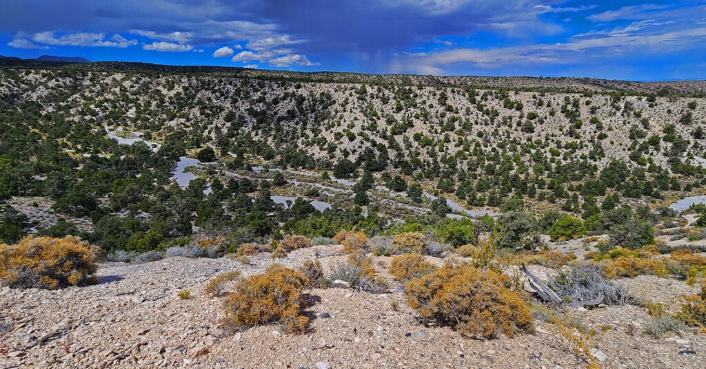
Experience Dynamic Terrain Changes from Pine-Covered Slopes to Lee Canyon Narrows. Click the image or title above for details.
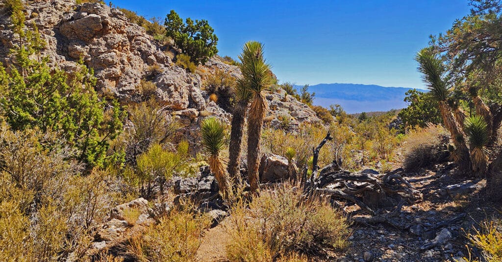
Amargosa Overlook | Mt. Charleston Wilderness | Spring Mountains, Nevada
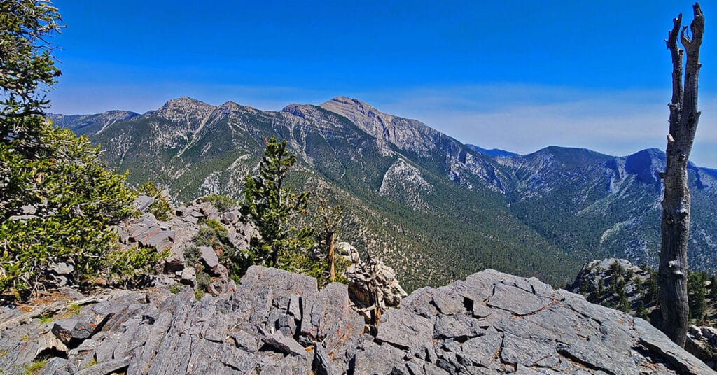
Enjoy a spectacular view overlooking Charleston Peak and the Amargosa Valley from a 10,154ft high point above Lee Canyon, Nevada. Click the image or title above for details.
Sawmill Loop Trail | Sawmill Trailhead | Lee Canyon, Nevada
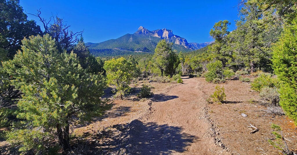
The 1.5-mile Sawmill Loop Trail is the hub for all six trails branching off from the Sawmill Trailhead area in Lee Canyon Nevada. Understanding this trail and its connections is the key to navigating the Sawmill area. Click the image or title above for details.
Rocky Gorge Loop Trail | Sawmill Trailhead Area | Lee Canyon, Nevada
This intimate little gorge is like a desert bonsai garden! Though the loop trail is hidden away in Lee Canyon with no visible trailheads, it’s well worth the search! | Click the Image or Title Above for Details
Sawmill Trailhead Trails | Lee Canyon | Mt Charleston Wilderness, Nevada

Enjoy 6 beautiful, forested trails on the Eastern slopes of Southern Nevada’s Spring Mountains. Click the image or title above to view the trails.
Mummy’s Chin Summit Ridge Loop | Mt Charleston Wilderness, Nevada

Approach this wild, fairly untouched and unknown rocky alpine ridgeline from Deer Creek Road, enjoy spectacular views, then return via the Lee Canyon Mummy’s Nose approach saddle for an incredible loop of the Mummy’s Head region. Click the image or title above for details.
Mummy’s Forehead Summit Approach Gully | Mt Charleston Wilderness, Nevada

This is a streamlined approach from Deer Creek Rd. Catch Pen Loop trailhead parking area to connect with Mummy’s Forehead Summit Approach Gully midway to the summit. On the return trip we explore the large area of ridges and gullies between Camp Stimpson and the Catch Pen Loop trailhead. Click the image or title above for details.
Mummy’s Forehead Lower Camp Stimpson Gully Exploration | Mt Charleston Wilderness, Nevada

↑ Slide Guide ↑ ↑ Slide Guide ↑ Mt. Charleston Wilderness BLM Fact Sheet Mummy’s Forehead Lower Camp Stimpson Gully Exploration | Mt Charleston Wilderness, Nevada Spring Mountains NRA Brochure ↓ Video Guide ↓ Overview | Mummy’s Forehead Lower Camp Stimpson Gully Exploration | Mt Charleston Wilderness, Nevada This […]
Mummy’s Nose East Cliff Plane Crash Site | Mt Charleston Wilderness, Nevada

While streamlining a route to Mummy’s Forehead I stumbled across a plane crash site at the Eastern cliffs of Mummy’s Nose. Initial research shows no record of this crash site. Click the image or title above for details.