La Madre Mt, El Padre Mt, Burnt Peak | La Madre Mountains Wilderness, Nevada

This adventure summits three of the highest peaks in the La Madre Mountains Wilderness to the West of Las Vegas, Nevada: La Madre Mountain, El Padre Mountain and Burnt Peak from the intersection of Kyle Canyon and lower Harris Springs Roads. The entire adventure took about 17 hours (including getting bogged down in a lower wash) compared to my recent completion of the Mt. Charleston Loop in 7 and a half hours! The La Madre Mountain, El Padre Mountain and Burnt Peak circuit offers incredible views all along the way including the Mt. Charleston Wilderness with Griffith Peak, Charleston Peak, Lee Peak, Mummy Mountain, Fletcher Peak and Angel Peak to the West. Then there is the Sheep Range, Fossil Ridge and Gass Peak to the Northeast. Add spectacular aerial views of Las Vegas Valley and the Las Vegas Strip with Frenchman Mountain and Lake Mead in the background to the East. Then add Calico Basin, Calico Hills, Damsel Peak, Red Rock Park, Turtlehead Peak, White Rock Mountain and the Rainbow Mountains all the way to Potosi Mountain to the Southwest including Bridge Mountain, North Peak, Rainbow Mountain, Juniper Peak, Mt. Wilson, Indecision Peak and Windy Mountain. Route details: 25+ Miles RT / 4500-8,500ft; *Some Road, Mostly Wilderness* Click image or title above for more…
La Madre Mountains Wilderness High Elevation Perspective | La Madre Mountains Wilderness, Nevada

Standing on a high point just West of the Devil’s Slide (also referred to at the La Madre Mountain Scar), I was able to view the exact spot where the Southern Pass emerged from between the La Madre Mountain and El Padre Mountain cliffs originating in Calico Basin. At the same time I was able to look West along the top of the Keystone Thrust to see where the Western Approach originating in the Willow Springs area of Red Rock Park emerged at the summit of El Padre Mountain. Finally, looking North I was able to see the entire Northern approach route originating at the intersection of Kyle Canyon Road and Harris Springs Road. In short, this was an experience in “connecting the dots” in the La Madre Mountains Wilderness. Route Details: 21 mi / 4500-7800ft; *Some Road, Mostly Wilderness* Click image or title above for more…
Red Springs Desert Oasis | Calico Basin | Red Rock Canyon National Conservation Area, Nevada

What makes Red Springs Desert Oasis so amazing is the lush, spring-fed vegetation in the midst of a surrounding desert. And, there’s a half-mile board walk, wheel-chair accessible, that brings the entire oasis within easy reach. Both the elderly and families with toddlers can easily enjoy this desert oasis experience. If you’re a serious walker, the boardwalk makes a great alternative to walking on boring asphalt neighborhood roads. You could do laps and extend your walk for a few miles. Route details: 1 mile board walk loop. Click image or title above for more…
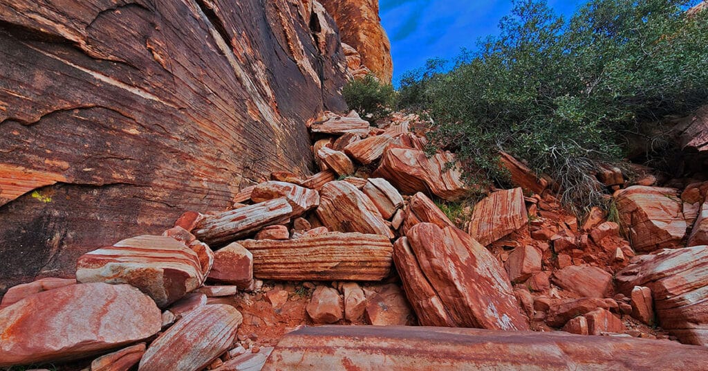
Kraft Mountain Loop | Calico Basin | Red Rock Canyon National Conservation Area, Nevada

Kraft Mountain Loop circles the base of Kraft Mountain located in the Calico Basin, Nevada (last turn-off before Red Rock Park). During this 3.5 mile loop you will experience navigating colorful Jurassic era frozen sand dune formations, incredible vistas of the surrounding area and some class 2-3 scrambling up and down sandstone ledges in a desert wash. It’s highly recommended that you undertake this adventure on a Fall, Winter or Spring day to avoid excessive Summer temperatures that can exceed 115 degrees. And, do not attempt this under wet conditions (rain, snow) because the sandstone you will need to traverse and climb can become as slick as ice! Route description: **3.5 Miles, 3,710 – 4,299ft Elevation ** Click image or title above for more…
Kraft Mountain – Gateway Canyon Loop | Calico Basin | Red Rock Canyon National Conservation Area, Nevada

On this day I intentionally set out to head up Gateway Canyon thinking it might be a short cut to Damsel Peak. Wrong! Between figuring out the best way to navigate 10-15 class 3 and class 3 barriers, I ate up so much time that I decided to just make a large loop out of Gateway Canyon, continuing all the way to Brownstone Basin at the base of Damsel Peak, and then taking Brownstone Basin down to a cross-over point back to Kraft Mountain. Many hikers have mistakenly taken this route thinking they are on the Kraft Mountain Loop. I made this very mistake on my first attempt to do the Kraft Mountain Loop! In fact, during today’s adventure, I redirected 2 groups of appreciative hikers back to the Kraft Mountain Loop. Here’s how that error happens… Route details: Approx . (12 mi.) | 3,700-5,400ft Elevation; **Some Trail, Mostly Wilderness** Click image or title above for more…
Damsel Peak Southern Approach Route from Calico Basin, Nevada

The Southern approach to the summit of Damsel Peak (aka Pincushion Mt) in Nevada begins at the trailhead parking area in Calico Basin, navigates to the South side of Damsel Peak, traverses to the North side, descends into Brownstone Basin then navigates back to the starting point in Calico Basin. Incredible views from the summit of Damsel Peak include almost all of the Las Vegas Valley, Brownstone and Calico Basins, Turtlehead Peak, the Calico Hills, Mt. Wilson, Rainbow Mountain, Juniper Peak, North Peak and Bridge Mountain and finally the huge expanse of the Keystone Thrust cliffs with La Madre Mountain as the high point. To the North one can see Gass Peak, the Sheep Range and Fossil Ridge. Route details: Approx 15 mi RT; **No Trails, Some Class 3 Climbing** Click image or title above for more…
Damsel Peak Northern Approach | Red Rock Canyon National Conservation Area, Nevada

From the top of Damsel Peak outside of Las Vegas, Nevada one can see almost all of the Las Vegas Valley in the same way that Damsel Peak is visible from just about anywhere in Las Vegas Valley. In addition, there is an awesome view of the entire Calico Basin, Turtlehead Peak, the Calico Hills, Mt. Wilson, Rainbow Mountain, Juniper Peak, North Peak and Bridge Mountain and finally the huge expanse of the Keystone Thrust cliffs with La Madre Mountain as the high point. To the North one can see Gass Peak, the Sheep Range and Fossil Ridge. Route details: 16 mi Start Sandstone Quarry Red Rock | 4370 > 6977ft; **Wilderness, No Trail** Click image or title above for more…
02 Red Rock Canyon Scenic Drive | Red Rock Canyon NCA, Nevada

General information for Red Rock Canyon NCA including how to work the reservation system is on this page. In addition, the 10 points of interest along the Red Rock Canyon Scenic Drive are described. I’ll mention the trailheads from these points as jumping off points for wilderness adventures, but realize that the scenic drive is in itself a totally rewarding experience even if you don’t get out of your car! 13-mile scenic loop drive. Click image or title above for more…
Grand Circle | Calico Basin | Red Rock Canyon National Conservation Area, Nevada

The Calico Hills form a boarder between lower Red Rock Canyon and lower Calico Basin in Nevada. The Calico Hills form a boarder between lower Red Rock Canyon and lower Calico Basin in Nevada. The Lower Calico Hills Loop follows a 5-mile series of 4 trails around the circumference of the Calico Hills. The Calico Hills are composed of ancient Jurassic Era sand dunes that have been frozen into an artistic display of fantastic shapes, colors and designs. From a distance the Calico Hills are dwarfed by the larger surrounding formations. However looks are very deceiving as the closer you get these formations become huge with 30-40ft sheer drop-offs. Route description: 5mi Loop Circles Calico Hills; *Fairly Good Trail, Sketchy in Places – Some Steep Rocky Stretches* Click image or title above for more…
Grand Staircase | Calico Basin | Red Rock National Conservation Area, Nevada
The Calico Hills form a boarder between lower Red Rock Canyon and lower Calico Basin in Nevada. These ancient sand dunes have been frozen into an artistic display of fantastic shapes, colors and designs. The most popular route up the Calico Hills is called The Grand Staircase. As you stand in the parking area in the Red Springs Desert Oasis in the Calico Basin and look closely at the Calico Hills towering above you’ll see a natural diagonal route that begins in the mid section and angles up to the right and to the summit of the hills. This is the Grand Staircase. Route Details: Approx. (2 mi. RT); **Wilderness, Sketchy Path, Class 3 Rock Climbing** Click image or title above for more…