
Mt Wilson to Juniper Peak | Rainbow Mountains, Nevada

Traverse the Rainbow Mountains Upper Crest Ridgeline in Nevada from Mt Wilson to Juniper Peak. Beginning on Lovell Canyon Road, ascend to the Upper Crest Ridgeline above Mt. Wilson, head North to the ridgeline above Juniper Peak, then descend again into Lovell Canyon. Click the image or title above for more detail.
Mt Wilson Summit Saddle from Lovell Canyon, Nevada

Hike from Lovell Canyon to the Rainbow Mountains Upper Crest Ridgeline above Mt. Wilson. Then, descend from the ridgeline to the saddle between the ridgeline and Mt. Wilson. Here we explore that steep slope between the Rainbow Mts. Upper Crest Ridgeline and the Mt. Wilson Summit Saddle. Best time of year for this adventure is mid-Spring through Fall. Late June through early August may bring uncomfortably high heat. Click the image or title above for details.
Mt Wilson Summit from Lovell Canyon | Rainbow Mountains, Nevada

The traditional summit route to Mt. Wilson (elevation 7,071ft) is from First Creek Canyon below. But did you know it was also possible to descend to the summit of Mt. Wilson from the Rainbow Mountains Upper Crest Ridgeline above? This entire, fairly isolated back-wilderness route is a class 2-3 walk, though along some steep slopes. The reward is incredible–a famous, prominent summit seen from Las Vegas and beyond! Click the image or title above for more detail.
Mini Matterhorn Pinnacle North Twin | Wilson Ridge | Lovell Canyon, Nevada

Take a wild, untouched approach ridge from Lovell Canyon Road just South of CC Spring Turn-off to the base of the North Twin Mini Matterhorn Pinnacle on the Wilson Ridge. There are twin pinnacles just North of Red Rock Summit on the Wilson Ridge. Both have sharp drop-offs on three sides, conjuring up images, mini versions, of the Matterhorn. The East side of each pinnacle is a sheer thousand-foot cliff. The best time of year for this adventure is Spring or Fall. Summer my be too hot and Winter can bring icy conditions to the sheer drop-offs on this rocky ridgeline. Click the image or title above for more details.
Mini Matterhorn Pinnacle | Wilson Ridge | Lovell Canyon & Rainbow Mountains, Nevada

This short, but complicated and time-consuming route up a spectacular wild pathless approach ridge takes you to a pinnacle facing a sheer cliff along with dramatic drop-offs to the right and left. The one final approach path to the pinnacle is a narrow rocky spine of a ridgeline. It’s a wonder that one can accomplish this adventure without exceeding class 3 climbing! Best time of year for this adventure is late Fall or early Spring. Click the image or title above for more details.
Lower Wilson Ridge Loop | Lovell Canyon, Nevada

Rare Views of an isolated stretch of the Wilson Ridge and surrounding wilderness from this unique perspective. This is a big loop beginning at upper Lovell Canyon Road, ascending to the Wilson Ridge, then traversing the ridge South to Rocky Gap Road. Best time of year for this adventure: Late Spring or Early Fall with maximum daylight at this relatively cool temperature. Click title or image for more details.
Lovell Canyon Trail & Loop | Lovell Canyon, Nevada

Lovell Canyon trail quickly ascends and then follows a ridge on the Western side of Lovell Canyon with many grand views up the canyon to Griffith Peak and Harris Mountain. The canyon is beautiful, fairly untouched and features spectacular views of Griffith Peak, Harris Mountain and their long descent ridges on either side of Lovell Canyon. Lovell Canyon Trail branches into Lovell Canyon Loop which makes a large circuit around Handy Peak. Lovell Canyon Loop descends into Lovell Canyon’s main wash. In addition it provides access to Schaefer Springs Loop and Griffith Shadow Loop. Route details: About 5.5 Miles RT; **Excellent Trail** Click image or title above for more detail…
Lovell Canyon to Rainbow Mountains Upper Crest Ridgeline, Nevada

Travel from Lovell Canyon Campground to the Rainbow Mountains Upper Crest Ridgeline above Mt. Wilson in Nevada.
Lovell Canyon Roads | Lovell Canyon, Nevada
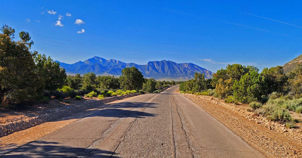
Lovell Canyon in Nevada has a great network of assess roads to camping areas, trails, and wilderness adventures throughout the canyon. Lovell Canyon Road, the main road is paved and 12 miles in length. The tributary roads are unpaved. Many are well graded, but 4WD is recommended and necessary in some cases. There are dispersed camping areas along the length of most roads in the network. Click the image or title above for more details…
Lovell Canyon Ridgelines | Lovell Canyon, Nevada

Lovell Canyon’s surrounding ridgelines create both a majestic and an intimate feeling. The ridgelines majestically tower over the canyon while enclosing it in its own unique setting. There’s the Wilson Ridgeline (East Side); Sexton Ridgeline (West Side); Griffith/Harris Saddle (North side); and The Rainbow Mountains Upper Crest Ridgeline (Southeast Region). From 5,000-11,000ft in elevation, the ridgelines offer spectacular views of Lovell Canyon and its surrounding wilderness areas. Click the image or title above to learn more.